-
SoCal Drought Emergency 2022
It looks like Southern California is headed back into a drought emergency as we roll into the hot months of 2022. Personally, I can’t say it’s a surprise as this has catastrophe has been growing on the horizon for months, if not years.
It’s the perfect confluence of too little rain and snow, growing populations and usage demands, and decades of bad ecological water management. You know, business as usual. I’m surprised Elon Musk hasn’t built desalinization plants from the boarder to the SF Bay.
With no benevolent problem solver, collectively it’s up to us, the people that are still living here to find a solution. Or at least elect people who are willing to see the issue and work to find equitable solutions so everyone here has access to clean fresh water.
But is the general public embracing the water crisis as a tangible problem, or is still in the abstract?
Read: Harvesting the Rain
The latest ask from the Metropolitan Water District of Southern California is “restricting outdoor watering to one day a week.”
The subhead of their press release reading:
Restriction aims to immediately reduce water use in communities with supplies severely limited by state drought
The message here, don’t water your lawns a lot. No, if it’s yellow, let it mellow. No, alarm bells that we’re in a century’s long drought with no long-term solutions other than relying on the chance it might rain, but not so much that it overwhelms our collection and storage facilities or washes off our hard road surfaces into storm drains and into the sea.
We’re reacting, not preparing.
Personally, I don’t think we’re doing enough to look at capturing run off into aquifers or mending poor compacted soils and rampant invasive natives that have made the landscapes hydrophobic and repel the little water that does fall from the sky.
We’re not changing with the change. The people who see and understand what’s going on aren’t at the table to work on the solutions.
My take to the whole thing? Why have a green lawn in the first place? Why grow a crop of a plant whose only productive existence is to occasionally walk barefoot or give the dog something to pee on. Green lawns are a crazy throwback to some golden era of picket fences, smaller populations, and wetter years.
It’s time to take out your lawn and replace it with native plants. Drought tolerant plants work, too, but if you’re going to the trouble to removing your lawn in the first place, why not make it a happy and sustain place for the native species around us, too?
The benefits of replacing your lawn are huge. Save water. Save money. Help fight climate change and reestablish valuable (vital) lost ecosystems as part of a suburban forest. The highest hurdle to removing a grass lawn is getting over the fact that when you look outside you don’t see an emerald carpet of thirsty sod. But many water companies or municipalities like the LADWP or San Diego County DPW offer incentives to removing lawns.
It’s something I’ve done. I realized a long time ago that trying to grow a lush green lawn in the middle of a drought was a losing game. So, who wait until the drought catastrophe gets worse? Get ready for it now.
-
Becoming A California Naturalist
Let me preface this by saying I believe we all have an inner naturalist. That part of us that’s drawn to organic vegetables, clean water, or a cool breeze through dappled sunlight filtered through tree leaves—the list could go on and on.
The UC Naturalist program says:
“the UC California Naturalist Program is designed to introduce Californians to the wonders of our unique ecology, engage the public in study and stewardship of California’s natural communities, and increase community and ecosystem resilience.”
To get there, one needs to find, or tap into, that inner passion for the natural world.
But nature is complicated and knowing where to begin or how to put all the different pieces together can be a challenge. When does being interested in nature become a passion for studying the natural world? More specifically, when does it become a passion for studying the natural world around you?
I don’t have an easy textbook answer for you. What I can describe is my journey to become a California Naturalist and what aspects inspire me to want to discover more.
An Urban Naturalist
The concept of a naturalist seems straightforward, someone who studies nature. How does one apply that in the urban setting? The notion of studying nature in a highly developed city like Los Angeles seems like an impossible thing to do with grids of suburban homes, miles, and miles of paved roadway. Not to forget the patchwork of small to intense industrial and commercial development that has come to define the metropolis. All of this, however, occupies what was once open space grass meadows, creek and riparian floodplain, oak, and sage/chaparral scrub forests.
Somewhere amidst the urban and suburban forest is the climates memory of the natural and native space. It’s this memory that has allowed a host of unique plants to not only grow here but thrive, in times past, and desperately struggle as the long-term impacts of mankind’s footprint transform the world around it.
Important to note, California is home to more endemic (unique, only occurring here) species than any other state. The California Department of Fish and Wildlife says that California hosts:
“6,500 species, subspecies, and varieties of plants that occur naturally in the state, and many of these are found nowhere else in the world.”
It’s also home to close to 30,000 species of bugs, fish, animals, birds, and amphibians. (Greg de Nevers, 2013)
Within that framework, humans have occupied the region in some capacity for more than 4,000 years going back to the early hunter gathers that evolved to become the Gabrielino-Tongva. Some sources put the first arrivals as far as 10,000 years ago, while others speculate at more than 100,000 years ago. Since that arrival, waves of occupation have washed across the state causing wave after wave of development and change to the landscape.
Anthropogenic Effects
As humans have occupied the natural space of California, each group cultivated the landscape to meet their needs.

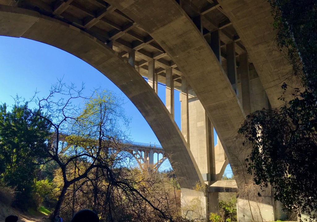
A span of the 134 freeway over the Lower Arroyo Seco in Pasadena, CA. Ancient peoples’ cultivated oaks, chia, and wildlife for substance and prosperity. Those who came after introduced grasses and ranchos for cattle, farms to grow crops and dairy, and orchards of citrus that grew well in the Mediterranean climate. All along, the occupants sought to shape the natural landscape to their will to get out of it some product for sustenance, profit, or pleasure.
Read: Best Hiking Shoes for Wide Feet with Plantar Fasciitis
In those pursuits, the city of Los Angeles has erupted as if out of the soil to meet the needs of modern occupants, disrupting what were once natural ecosystems and creating a fragmented patchwork of industrial, suburban, paved over spaced in-between groomed grassy spaces and remnant wild open space. This mix of developed and undeveloped patchwork has created a unique kaleidoscope of native plants co-habituating with non-natives fighting an increasingly losing battle over territory.

Looking south from the Upper Arroyo Seco in the Alta Dena foothills, into the West San Gabriel Valley towards Downtown Los Angeles. Wild vs. Semi-Wild
What does this battle have to do with being a naturalist? In many ways, I see this conflict between invasive/native plants as the epitome of our occupation in the Southern California region. Never mind the urban forest of lawns, water-hungry trees and shrubs, and agriculture. Our unique climate has given rise to a unique number of species. In the anthropogenic pursuits of freeways, skyscrapers, and suburban sprawl, we’re also coming to realize the cost of our development as heat (from climate change), health (from healthcare disparity and wealth inequality), and our ability to own or steward the remaining open space to preserve what little of the past is still present. Much of what we would consider as wild space is really space still within cellphone service and walking distance to a convenience store.
Very little is “wild” in the sense of what our grandparents would think of it as. I doubt our own grandchildren would be able to imagine the little we have now.
This is part of the seed that grows into becoming a California Naturalist.
In my own process, my study has taken me through several “wild” and “semi-wild” spaces. What I was able to see and take mental stock of was how nature, literally, finds a way. In much of the two sites of study, there has been a tremendous volume of human intervention: one in space necessary for human passage and the other on the outskirts of suburbia. In both places, it was impossible to not see the impacts of current and past anthropogenic influences.
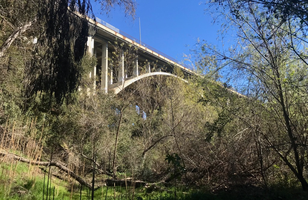
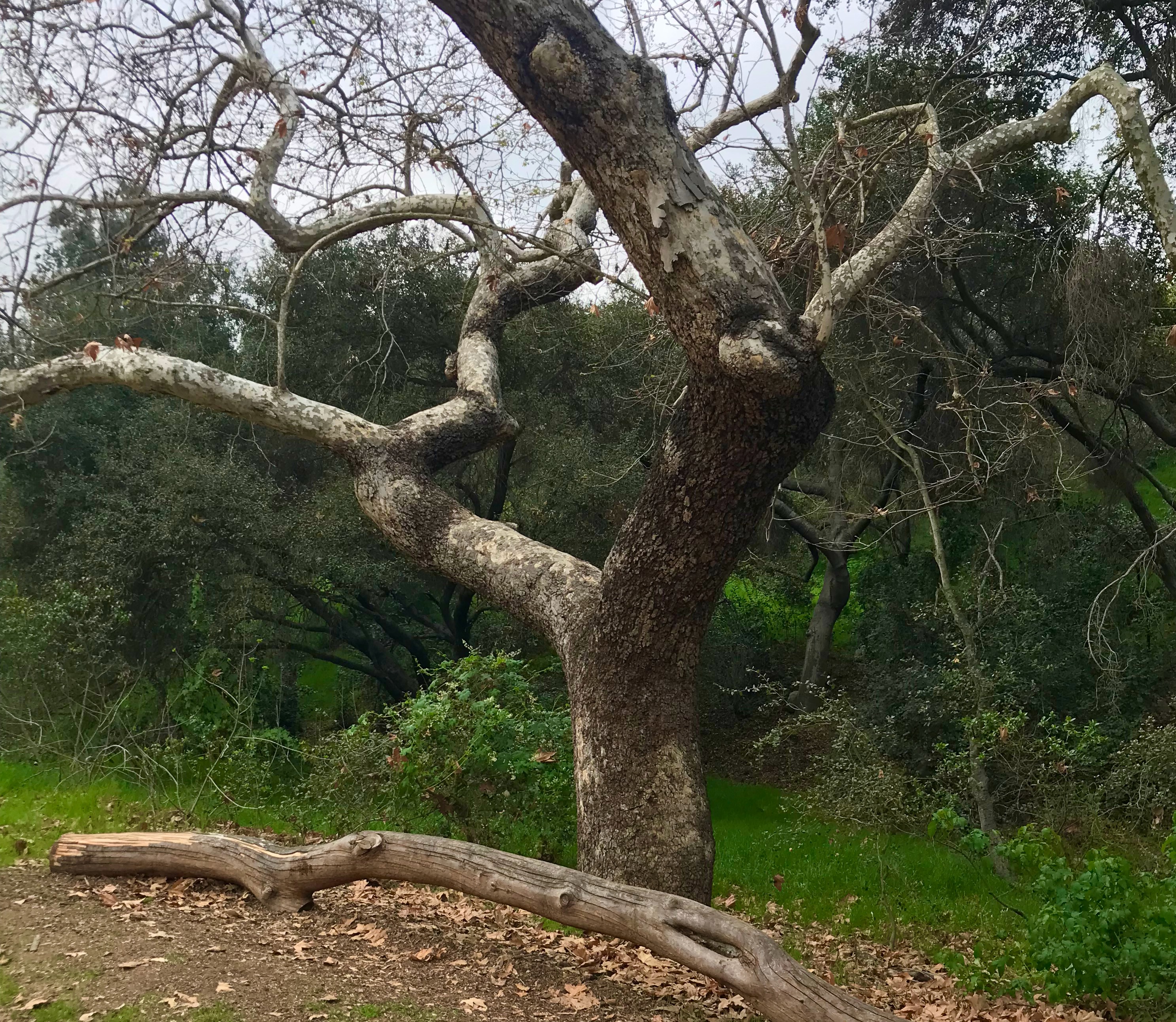
In a “wild space” in the Lower Arroyo Seco looking north towards the 134 freeway in Pasadena, CA. What did stand out, in contrast, was how one location (the Lower Arroyo) had several human interventions to bring back native plants in places long devoid of their presence because of the haphazard introduction of non-natives, human development, or liminal gaps between two ecosystems, split by the megalithic architecture of soaring freeway overpasses.
In the second location (the Upper Arroyo) The human presence was less pronounced, but still noticeable with old bridges, cabin foundations, and creature comforts marking the locations of long-vanished habitations. Roads, soaring utility poles, and a twisting maze of piping from waterworks announced that humans were still very much present in the space.

An old stone bench and steps to a long gone cabin along the Gould camp trail. In both examples, the wild vs. semi-wild felt less important to the fact that they were both just a stone’s throw from the rest of civilization. They existed in a mostly natural state because the environment dictated that they must. That the plants that grew in these regions, should and did grow there. What dictated how and where they grew was less about how it was planted and tended (if at all) and more about the underlying ability of the space to sustain the plants’ existence.

A giant toyon in the shadow of the 134 freeway and Colorado Street bridge. Patchwork Fragmentation
One of the last lessons in this process of becoming a California Naturalist was a lesson on community fragmentation. More specifically, the drivers of diversity might very much have to do with landscape ecology.
In short, the concept is that certain plants grow in communities of other plants in an ecosystem of support relative to the environmental aspects around them. In particular: how much groundwater (moisture) there is, the slope of the space and the quantity of and type of sun it gets, and the presence of plants that can act as incubators for other plant species to get established and grow in the space. The text for this course describes this landscape ecology as a mix of patch, matrix, mosaic, and corridor landscapes working in unison but fluid over time.

Plants growing in “patches” along hillsides of the Fern Truck Trail in the Upper Arroyo Seco. In the field, where this patch landscape ecology took shape was in observing how vegetation (in both wild and semi-wild spaces) followed a similar pattern of growing where the environment was best suited to nurture and encourage its growth.
In gardening terms, the right plant in the right place.
It struck me that this patchwork ecology that was occurring in the wild spaces was similar (if not the same thing) happening in the urban spaces as native and non-native plants become opportunists and populate hospitable landscapes, if not inviting, to exist in.
In effect, the anthropogenic impacts of human occupations are themselves, creating new ecosystems into which native plants can find footholds. It was in this context that the picture of my becoming a California naturalist crystalized.
Looking beyond the second bridge at the Upper Arroyo Seco in Alta Dena, CA. Accidental Ecosystems

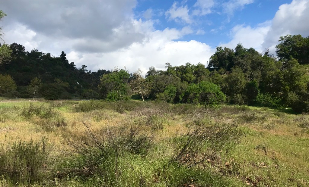
Looking south from the riparian ecosystem of the Lower Arroyo Seco into the meadow. The effects of all this city building have been the construction of a patchwork landscape of micro-climates, islands of ecology, and an urban forest of chemically fertilized lawns dotted in a patchwork quilt of weedy native lots, small native gardens, and hillsides aggressively holding to their fire-prone sage/chaparral ecosystems. At the same time, what was once wide riparian flood plains, oak forests, and meadowlands have been subsumed into the new urban sprawl.
It’s out of this new landscape, these natural and reclaimed spaces, that being a naturalist in the urban world exists. We think of suburbia as being all lawn and bungalow homes, when, the unique ecosystems of the pre-human California still exist in the patchwork landscapes between the anthropogenic footprints of human occupation. It may be as simple as a ground out millstone pits in rocks from early human occupants or large concrete water channels redirecting the flow of water through a space.
The Suburban Naturalist
The journey of becoming a California naturalist was less about a hard depth of subject plunge into the aspects of animal species, plant taxonomy, or geography (though these are all aspects of the process). Rather it seems more akin to understanding what’s going on in the spaces around you and how those things exist: place to place, season to season, location to location, even in a suburban setting.
The environment is a dynamic and fluid space. Ecosystems exist in many aspects and in many configurations with a variety of inputs and pressures. While human inputs create a unique set of pressures on a landscape, so do they create new habitats and ecosystems. From that understanding that an appreciation for studying nature can take hold.
-
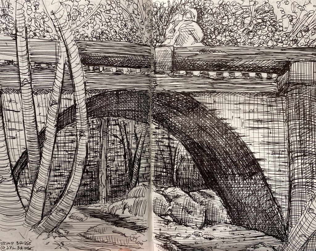
Upper Arroyo Seco – Visit 5
California Naturalist Outing
Upper Arroyo Park/Trail
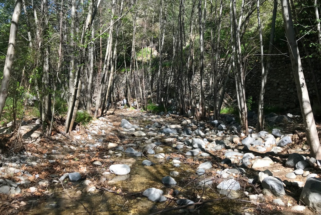
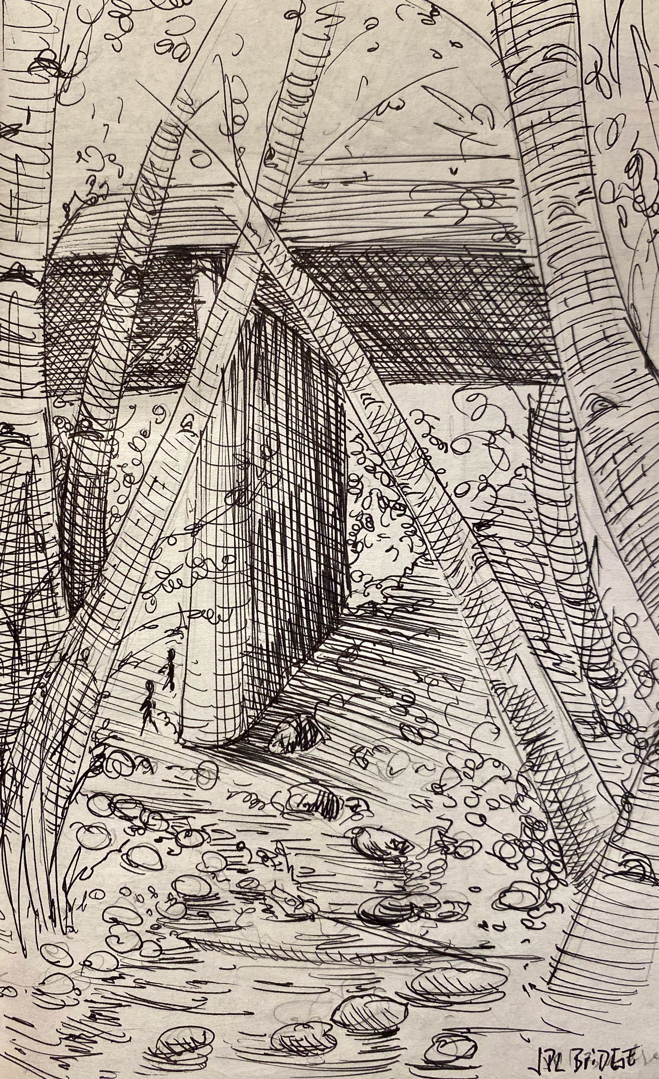
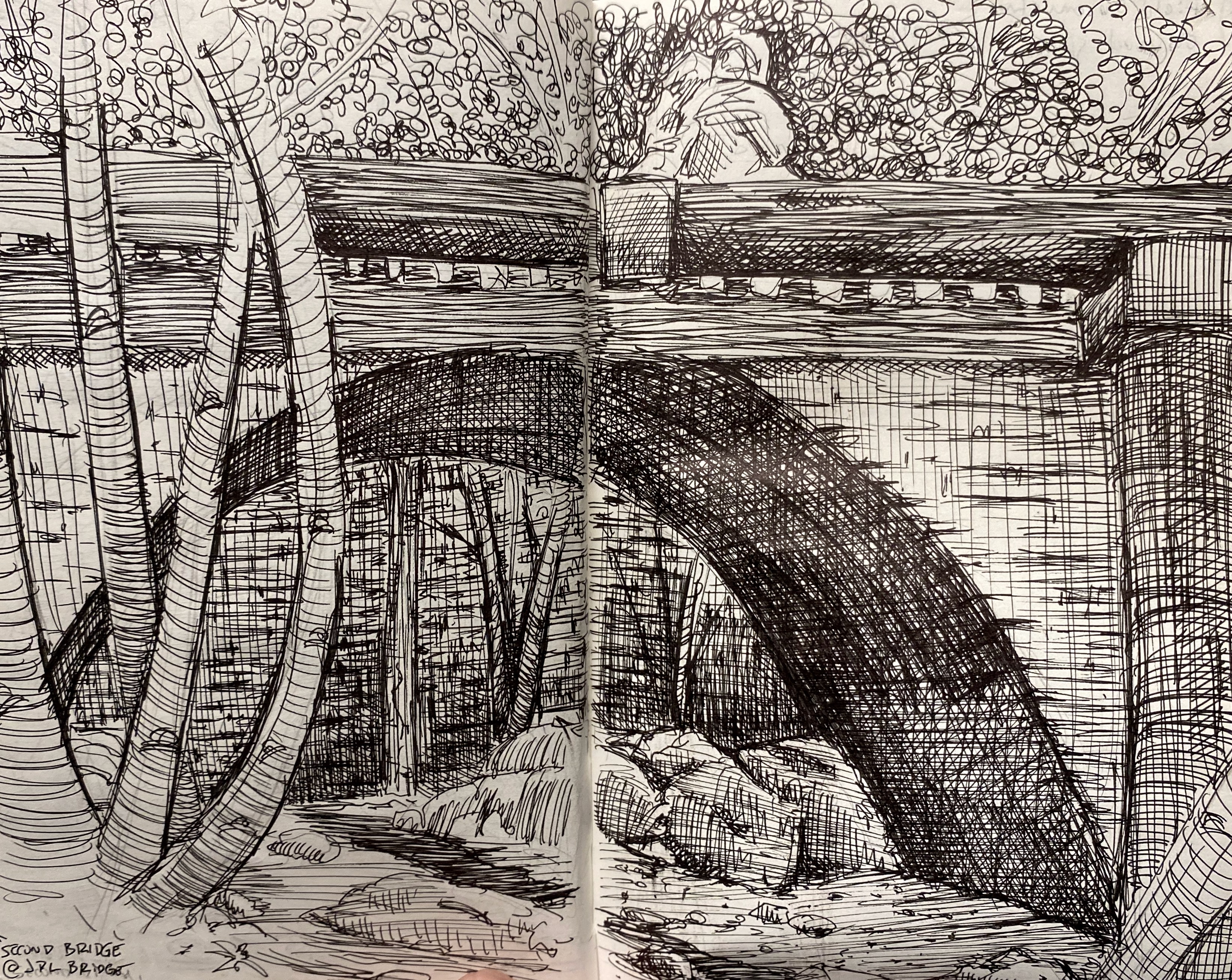
JPL Bridge to the Gould Mesa Trail camp
8:45 a.m. – 11:30 A.m.Route: Entering the canyon at the fence line, up the old road, following the left fork in the road towards the Gould Mesa Trail camp.
Weather: Cool, 51°F. Clear sky, crisp and windy (strong at times).
Visit to the Lower Arroyo Seco
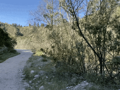
On this journey, my goal was to reach and observe the path up to the Gould Mesa Trail camp which is a short jaunt from the parking lot at the JPL Bridge. This trail was surprisingly busy for the mid-weekday with hikers, dog walkers, casual walkers, and young children in a school group.
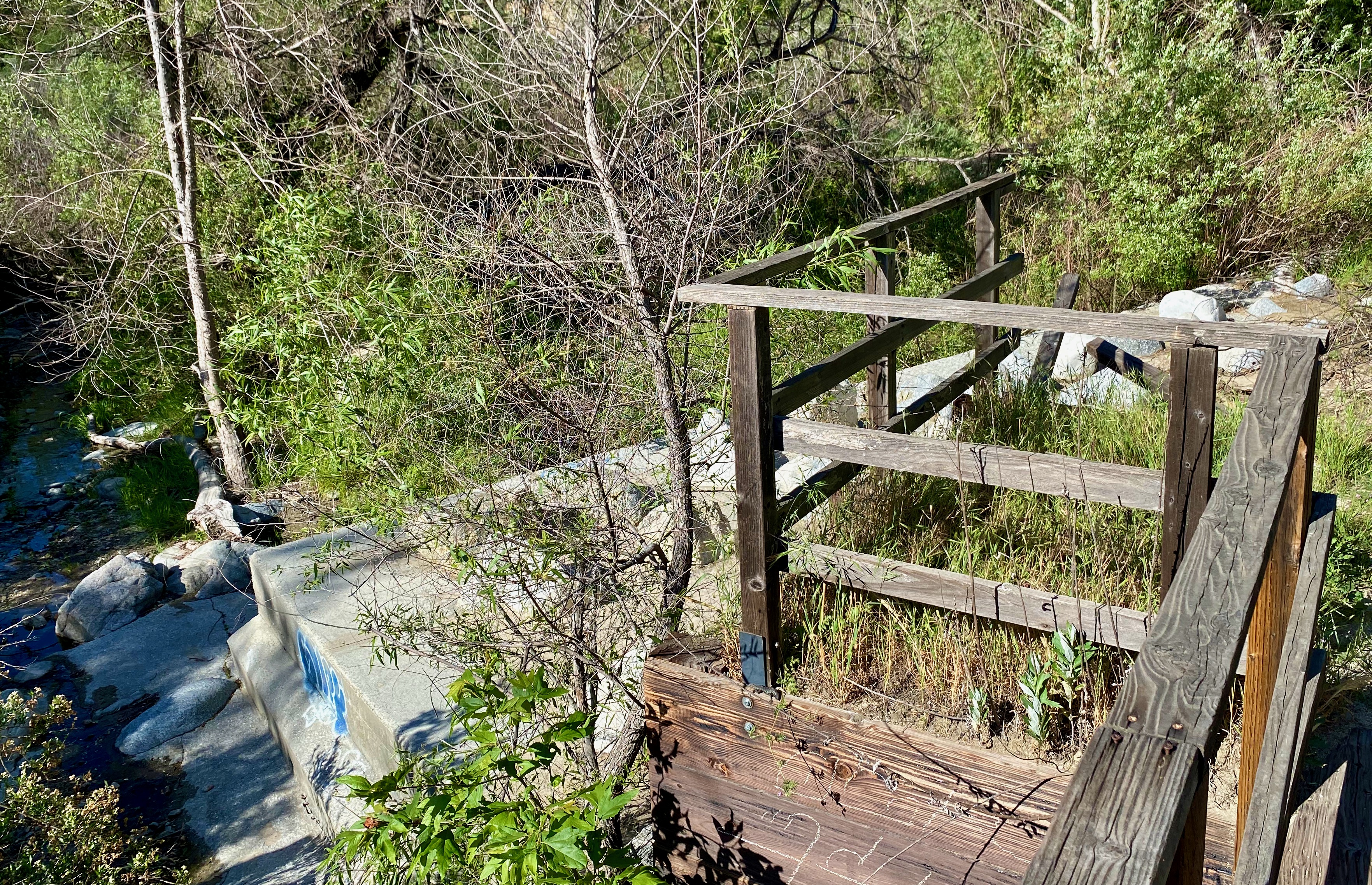
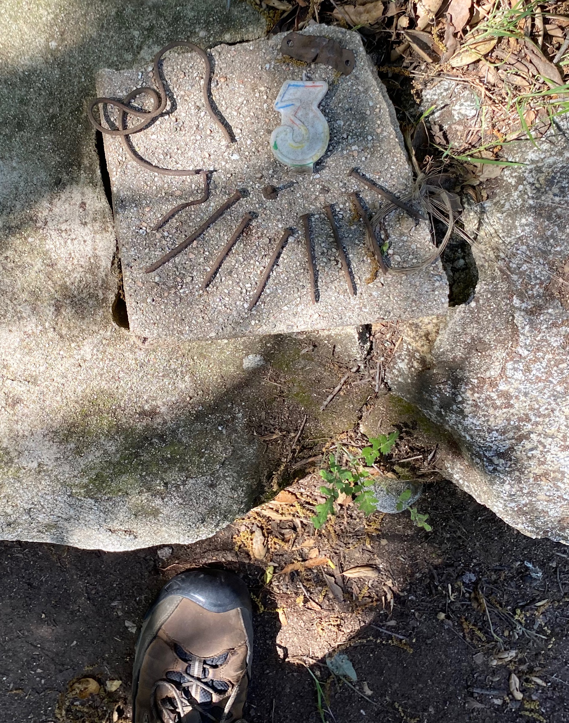
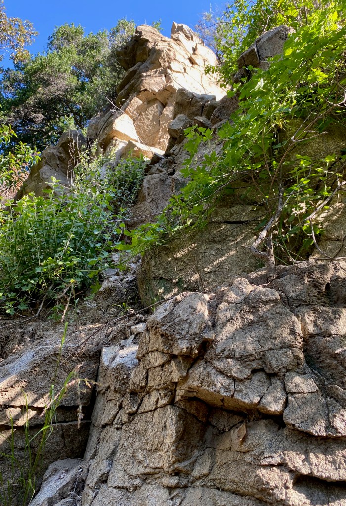
The trail was a mix of open, natural ecosystems, rock walls (with mixed composition granite), rick falls (some recent) and old structures—some of which were still in regular use as homes. There were several abandoned bridges and the remnants of old cabin homes, many of which still very much intact despite the building long gone from the site. It was amazing to see so many details from the structures including steps leading to nowhere, stone walls with built inviting river rock benches, and foundations set with grid precision. The juxtaposition was stark between the wild reclaiming the crafted.
The wind up in the canyon was strong but not prohibitive to being in the space. It alternatively howled and halted without forward or advance notice. At one point, the wind kicked up some irritant causing me to choke and cough, the cause of which I could never ascertain. Rinsing my mouth and getting out of the area it occurred in (just inside the foundation of an old cabin foundation) it stopped just as quick as it occurred.
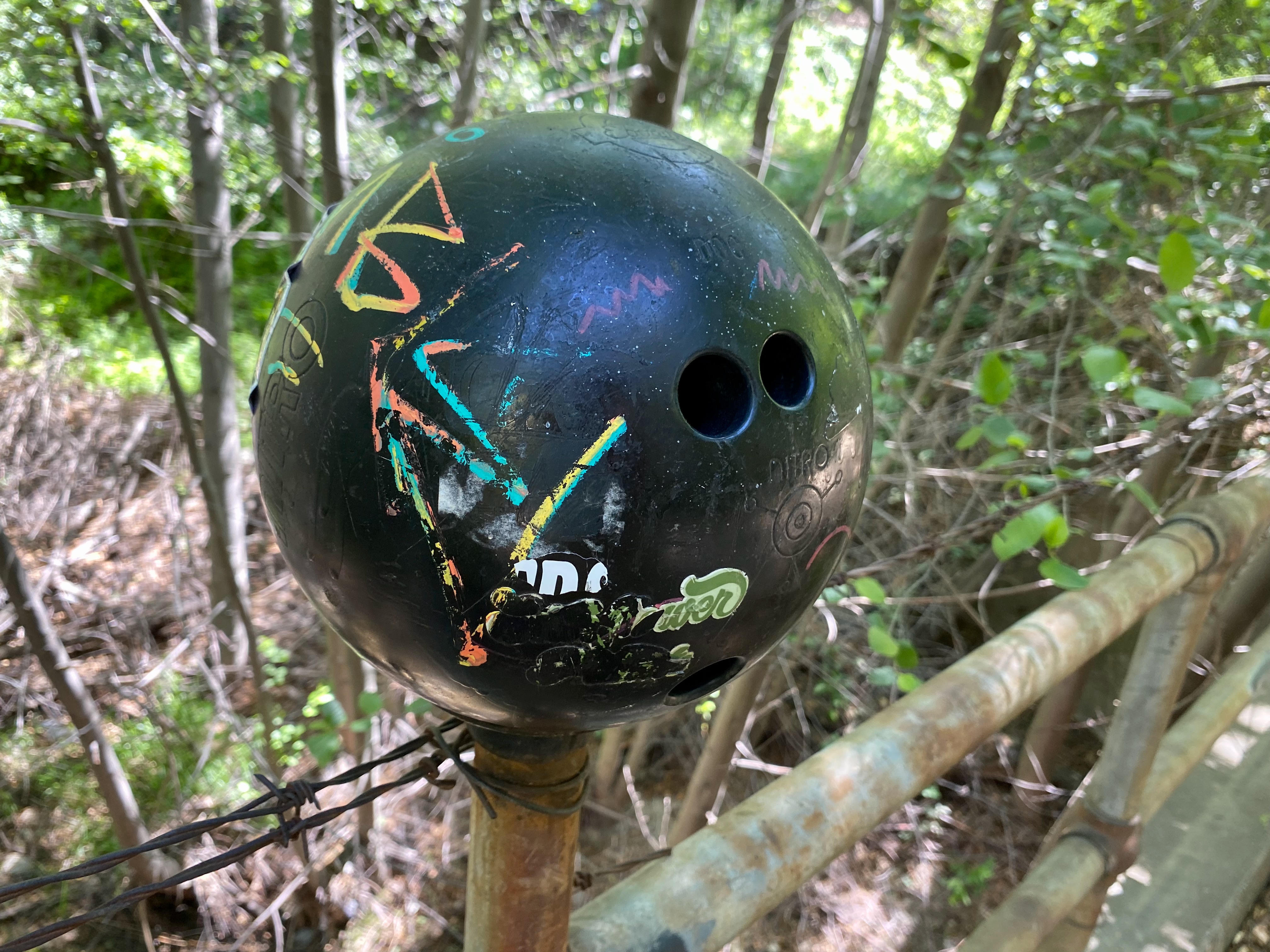
This path, if anything else, was a perfect specimen of a “wilderness trail.” It followed a meandering creek, twisting over and through it. Along the way were several old washed-out bridges blocked by with all manner of barriers. Wire fencing, barbed wire, physical barriers, and natural overgrowth—making the prohibited paths all the less inviting. If the old physical barriers weren’t interesting enough, along one bridge, a bowling ball was festooned on post, out of place, but tastefully situated as a clear waypoint to the campsite. For as wild as the space was, it still had plenty of signs of past human use and/or presence.

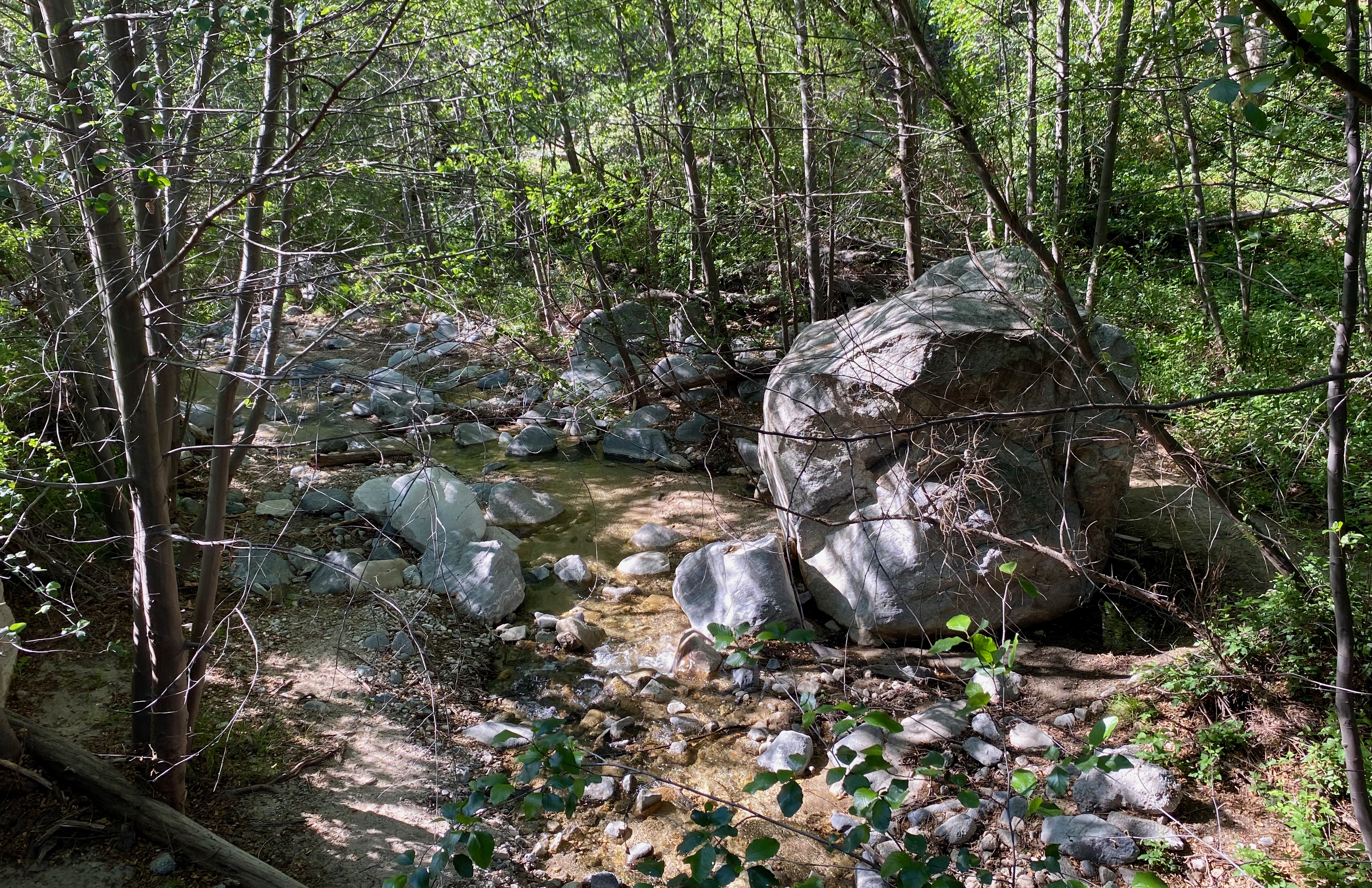
Unlike previous areas, this path seemed to have less fauna at the path edge. Birds were present, but not in great abundance or even in ear shot except for the occasional cooing of a pigeon. Leaving the path, I did venture down into the creek space to see what life was present, if any. I was delighted to see small fish (trout?) and what I later learned was a California newt. This native was in its aquatic form, swimming at the foot of a larger boulder in the creek bed.
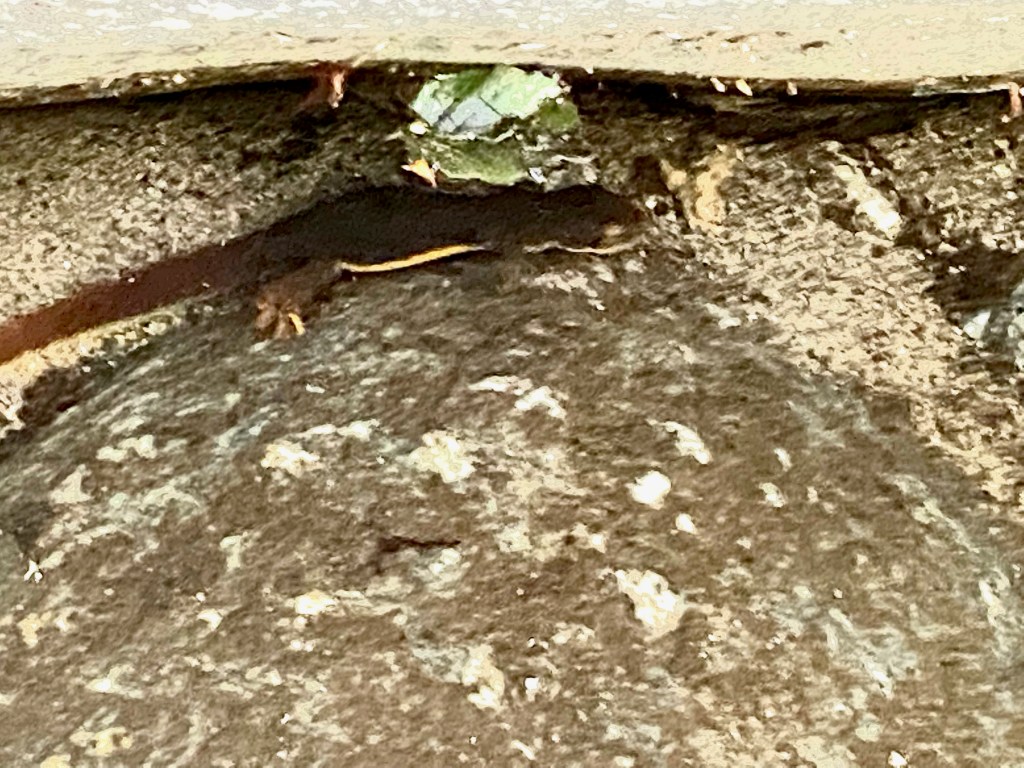
California Newt (Taricha torosa) These large boulders were a hallmark of this trip and found every few dozen feet in the trees and along the creek bed up the canyon floor. Many looked to be many years in place with lots of overgrown vegetation surrounding them. Some, like the one in the creek with the newt, seemed to be ideal hovels or dens of one kind or another for animals looking for shelter. None of the shelters made from the large boulders seems human size, but I can imagine both larger and smaller such dwellings exist in places less accessible to the day-tripper naturalist. The degree of rockfall was significant all along the path.


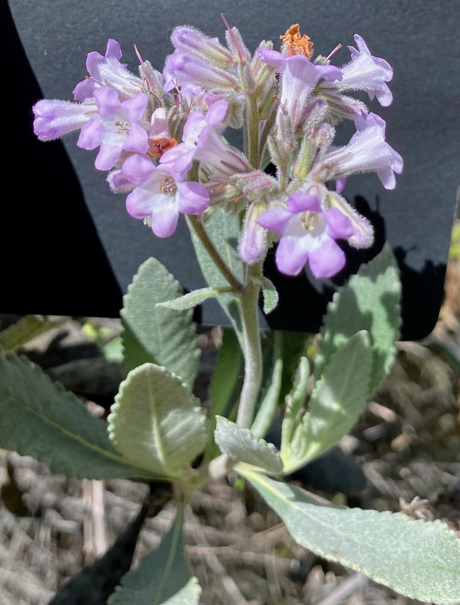
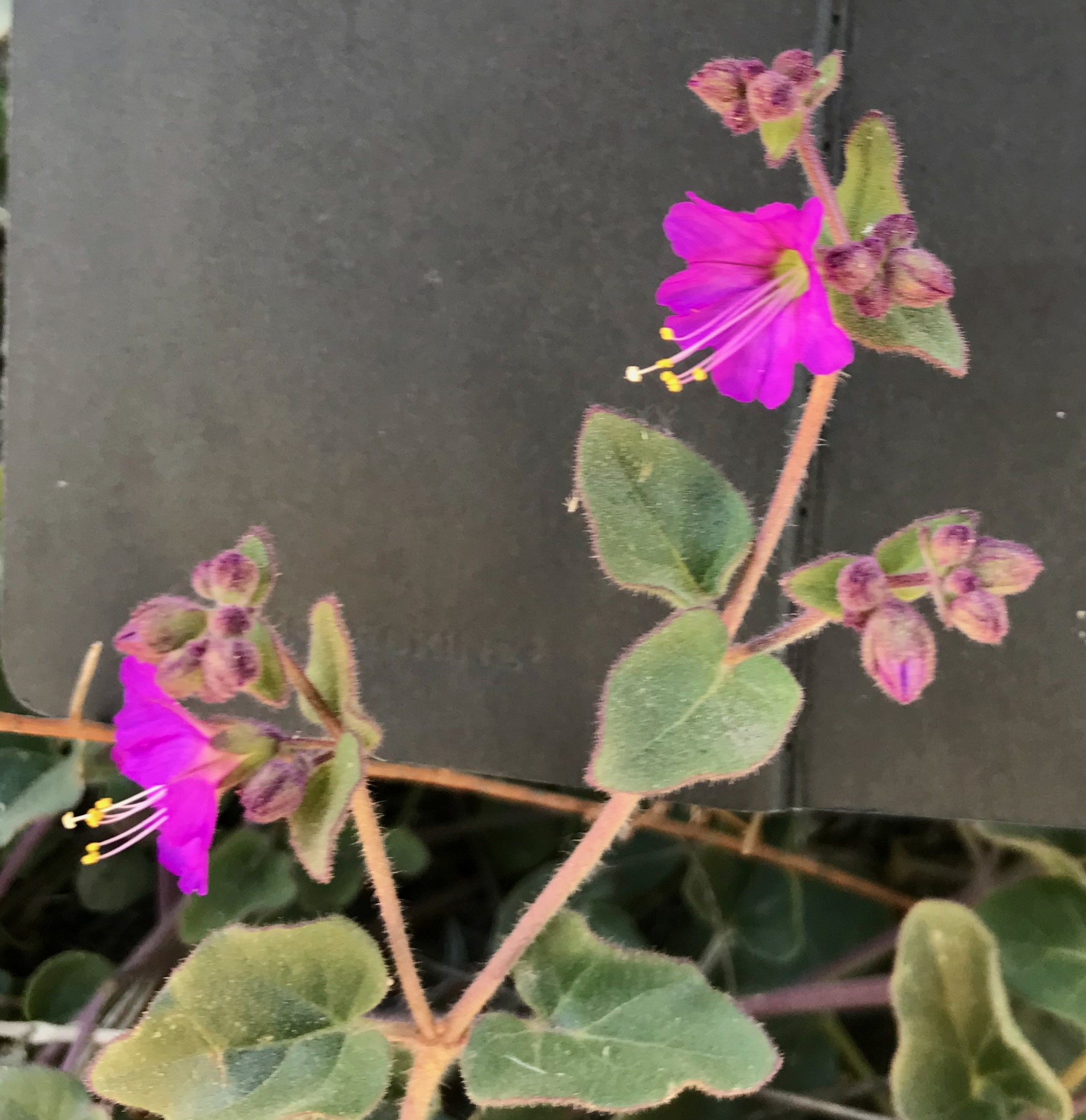
At one point along the path, a colleague and I walked through a meadow, of sorts, surrounded on both sides by riparian trees and shrubs on the creek side and oak and scrub ion the dryer, western, slope side. Remarkably the soil was near entirely dry and sand like form years and years of decomposing granite stone pulverizing into fine grains of sand. What was so remarkable was that it had the quality of beach sand and yet many plants were firmly anchored and growing happily. It was in this location that I found a Yerba Santa in bloom and a high volume of non-native grasses growing profusely between Laurel sumacs, sugar bush, and yucca. One of these sugar bushes was in full and resplendent bloom. It was the only one I found in the space this way—covered in pink, white, and read flowers.
Despite the many people along the trail, I did not see as much poison oak or hemlock. This told me that the path to the campground was less disturbed and filled in with other less advantageous plants. That’s not to say both weren’t just behind the trail, but they weren’t growing in what I would think to be disturbed areas. Why this was the case, I believe, was because the trail edges were relatively undisturbed, meaning few ventured off the trail and into the brush, not giving the toxic plants the opportunity to creep into the disturbed spaces.
Reaching the Gould camp, I took a few minutes to take it all in. It stood out to me how disturbed the camp site was with open dirt and few shrubs are the edges. There were several old cabin footings and all the accoutrements of a camp site. I noticed the same squared poured concrete floors, like old cabin footprints down the canyon.

Here, I turned back around and headed down the trail back to the parking lot listening to the wind pick up and roar through the canyons taking in the mix of native and non-native trees left over from times past when the presence of humans tried to shape the land to their personal tastes. I arrived back into civilization near noon and concluded my days trip.
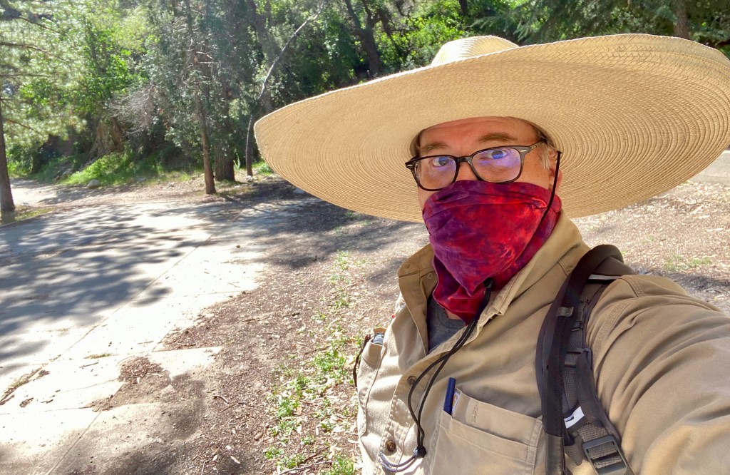
A rare photo, captured in the wild, of the man in the big yellow hat. Field Observations
- Lots of rock fall
- Large newt at the base of a rock
- Walkers, mountain bikes and young children in school groups
- Loud wind through the canyons
- Old infrastructure: bridges, cabins, walls
- Bowling ball on a bridge
- Not as much poison oak (non-disturbed spaces)
Observed Species
- Alder – Alnus rhombifolia
- Arroyo Willow – Salix lasiolepis
- Black Sage – Salvia mellifera
- Buckwheat – Eriogonum fasciculatum
- California Sage – Artemisia californica
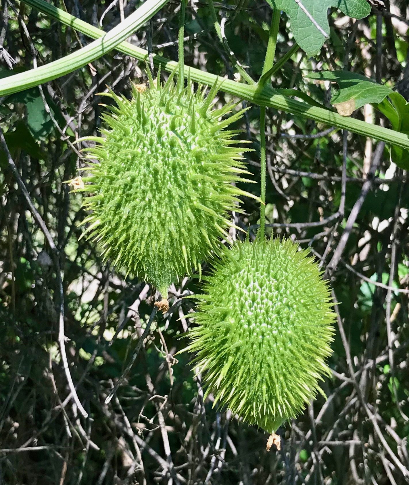
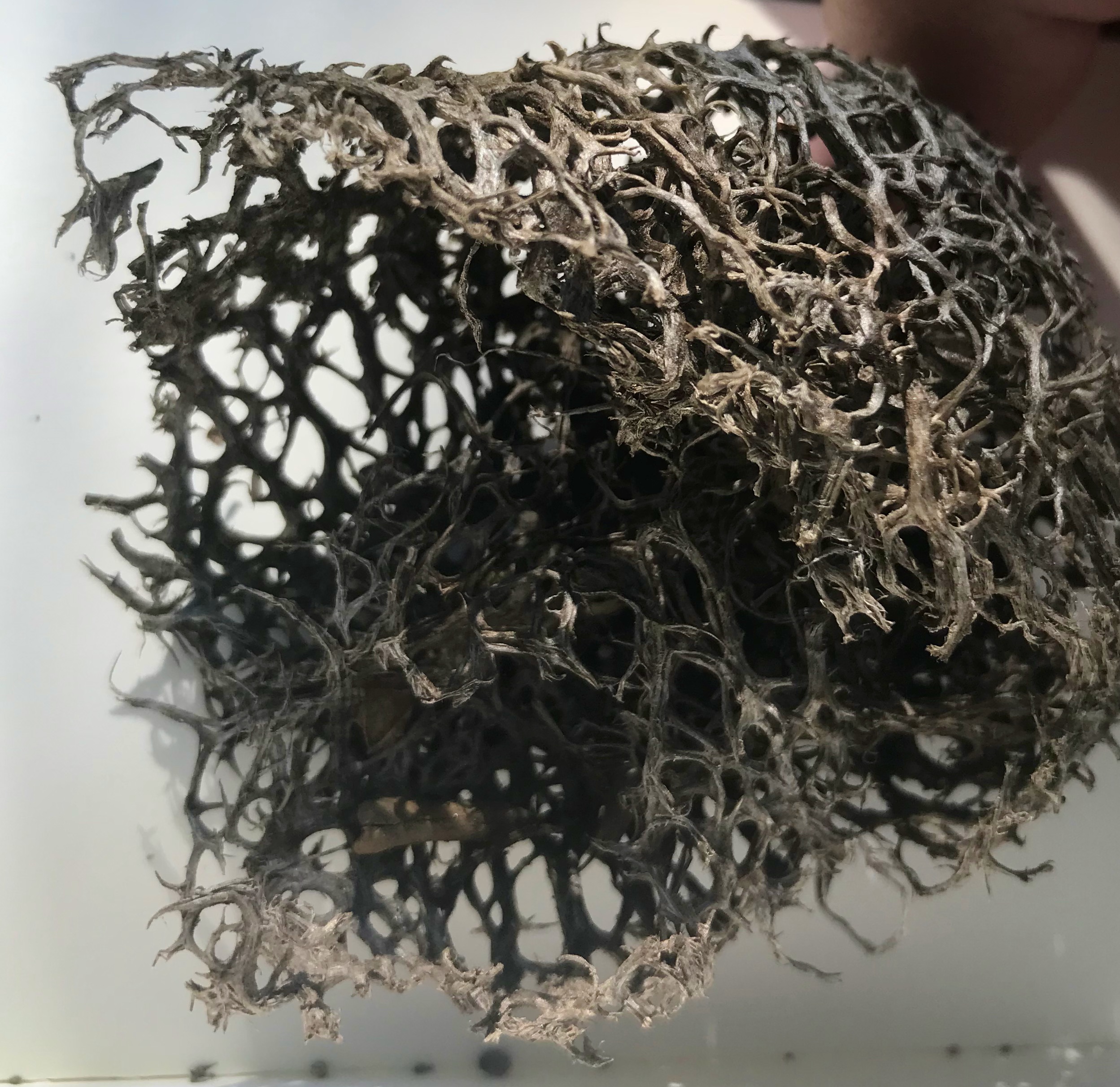
- Chilicothe – Marah macrocarpa
- Elderberry – Sambucus melanocarpa
- Laurel Sumac – Malosma laurina
- Mule Fat – Baccharis salicifolia
- Toyon – Heteromeles arbutifolia
- Western Sycamore – Platanus racemosa
- Mugwort – Artemisia douglasiana
- Castor Bean – Ricinus communis
- Tree tobacco – Nicotiana glauca
- Sugar Bush – Rhus ovata
- Wild Cucumber – Marah macrocarpa
- Thick-leaved Yerba Santa – Eriodictyon crassifolium
- Big Berry Manzanita – Arctostaphylos glauca
- Bigleaf Maple – Acer macrophyllum
- California Newt – Taricha torosa
- Pine Trees (several)
- Grasses (various)
- oak(s)
-
Upper Arroyo Seco – Visit 4
California Naturalist Outing
Upper Arroyo Park/Trail
JPL Bridge – Millard Canyon
8:45 a.m. – 11:30 A.m.- Route: Entering the canyon at the fence line, up the old road to the oak forest at the El Prieto Canyon Trail.
- Weather: 71°F (high of 89°F at end). Sunny and clear, not a cloud in sight.
Visit to the Lower Arroyo Seco
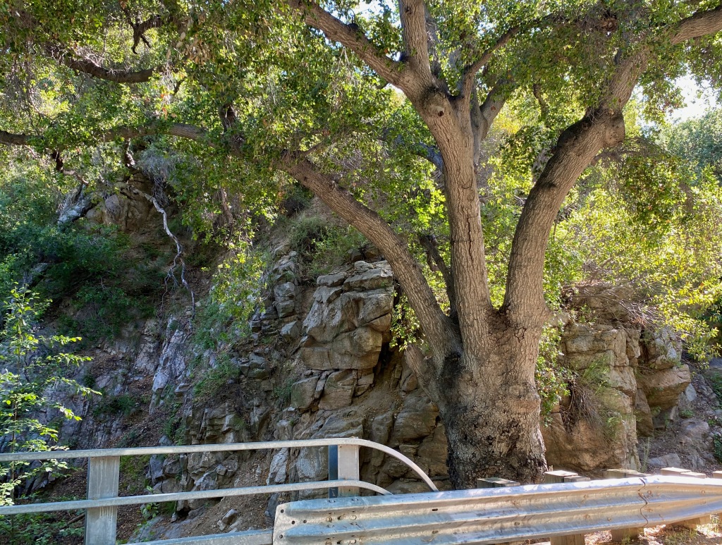
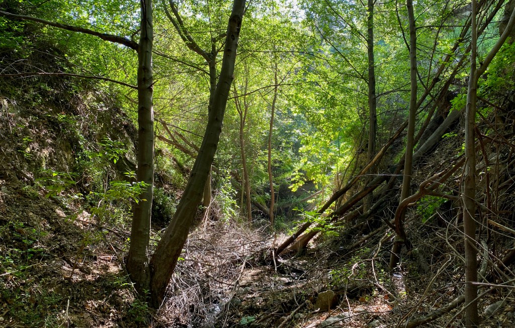
For this trip into the space, our goal was to look at the oak forest up into the El Prieto Trail. This path snaked up the northern side of a steep sloped canyon creating a unique example of patch ecology between riparian creek below, oak forest along the trail line and sage/chaparral high up on the hotter sun exposed slopes. This mix of space created an interesting microclimate or sorts from the presence of water, shade producing tree structures (oaks) the hot dry slopes that took the brunt of the morning and daytime sun.

An oak, clutching onto the side of a hill on the El Prieto Canyon Trail. In this configuration, the two axes of water and temperature made for the perfect boundary zones such that each of the patch communities could thrive and flourish in the space. I would add that the axis is a three-way measurement with the slope contributing to the sun exposure and temperature control.
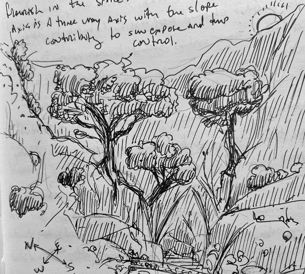
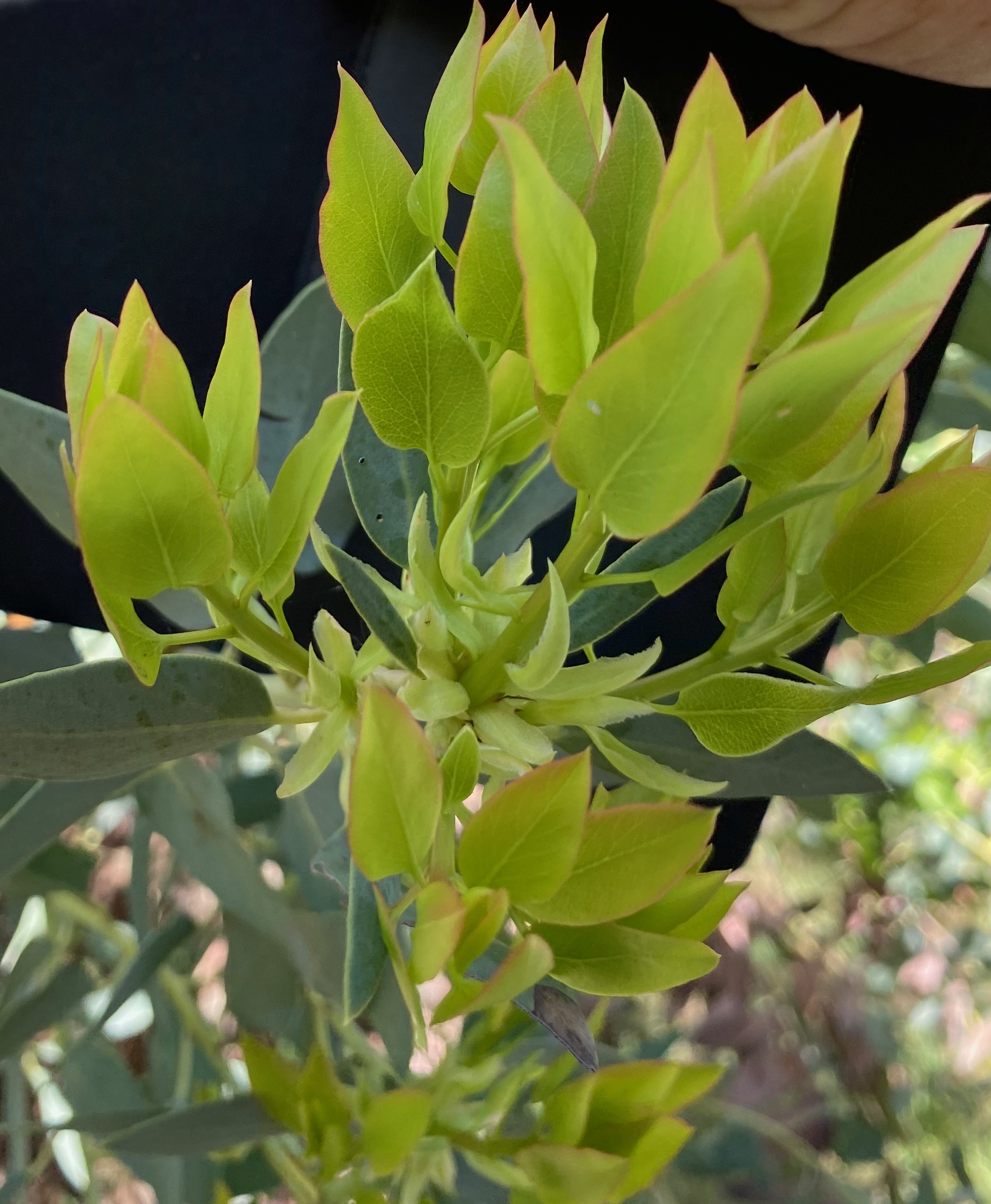
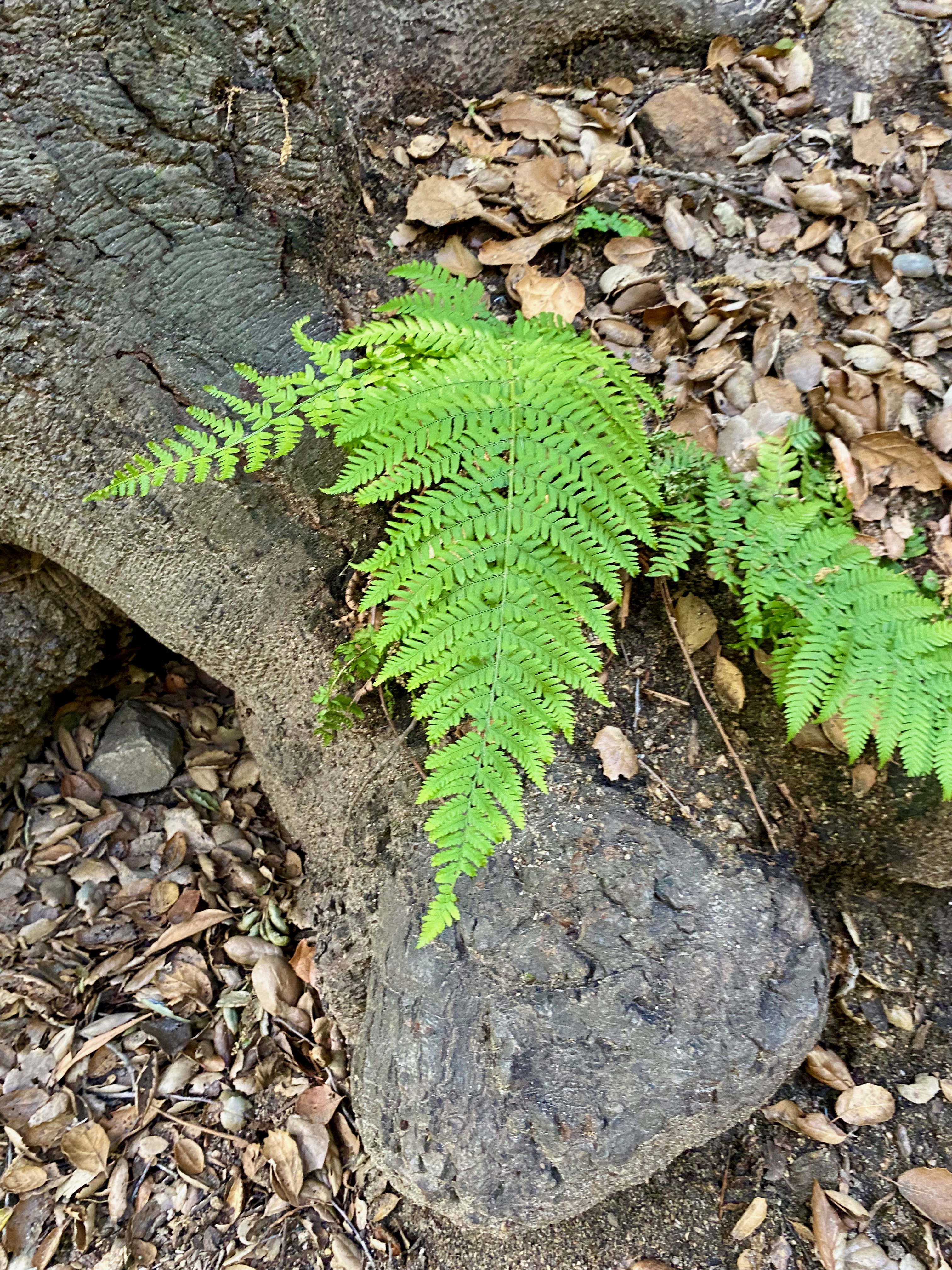
Slope effect on oak, sage and chaparral canyons. In much of the mixed communities, the leaf litter combined to make a thick mulch layer—three to four inches deep. Below the detritus, the loamy soil was still damp to the touch, despite having rained a week or more prior. And, like any good opportunists, non-native plants such as castor bean, Asian elm and invasive mustard showed itself in the space. Interestingly, none of these non-natives seemed to overpower the native plants—maybe as only early colonizers, but it seemed they had a much harder time growing in the non-disturbed space. This struck me as a sign of the trail ecology as being healthy and thick while nearby spaces with less water and more exposure, struggled. Trees and shade played a huge factor. In the dappled sunlight on the edges, grasses of all manner of origin grew along with patches of hemlock, coastal wood ferns, scorpion weed, and pacific pea grew side by side poison oak and other riparian ecology.


Throughout, lots of Chillicothe grew through and into shrubs and trees along the trail, along with large healthy toyon and black sage. All of which in its own unique biologic niche occupying and sharing spaces that to a casual passerby would seem impossible to call home. In many cases, to get a plant ID or even a snapshot would require a daring feat of leaning over an edge of the steep slope to grab a branch or flowering stem.
For early April, the space felt alive and happy.
Even the wildlife was out in abundance. Hover flies and gnats darted around, a beehive of some composition hummed just off the trail, and hummingbirds, wren, doves, and woodpeckers foraged and went about their daily existence. I was surprised at the number of butterflies and caterpillars about, even so much as to capture a photo of a White-lined Sphinx caterpillar just going about its business.
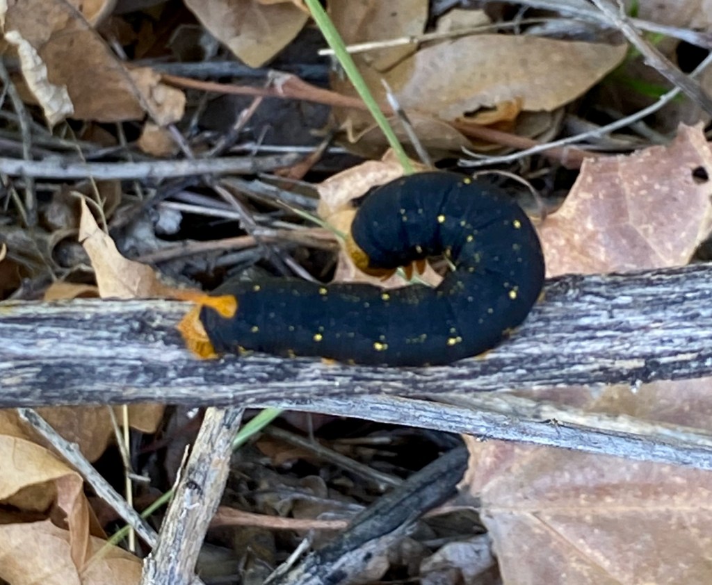
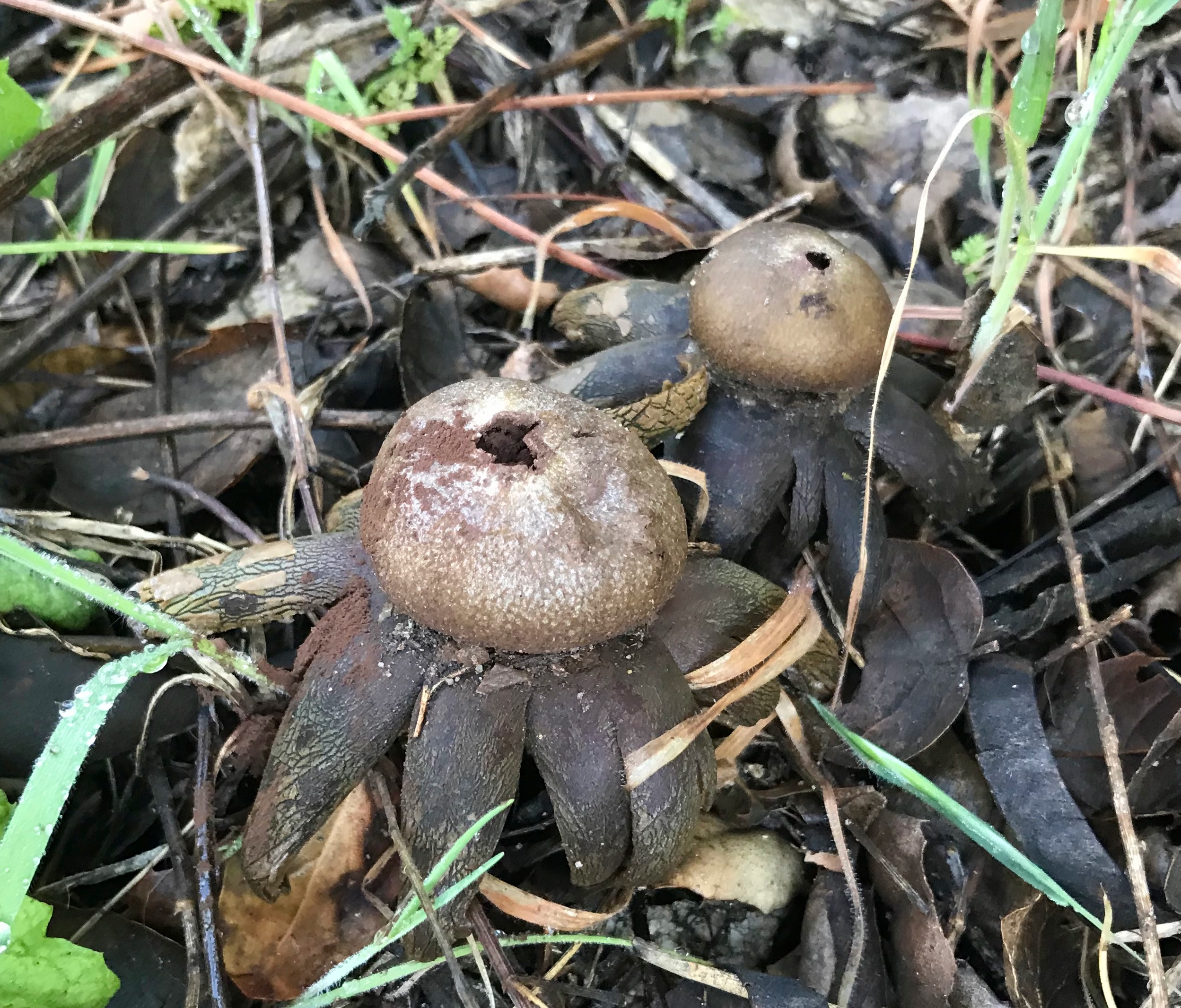
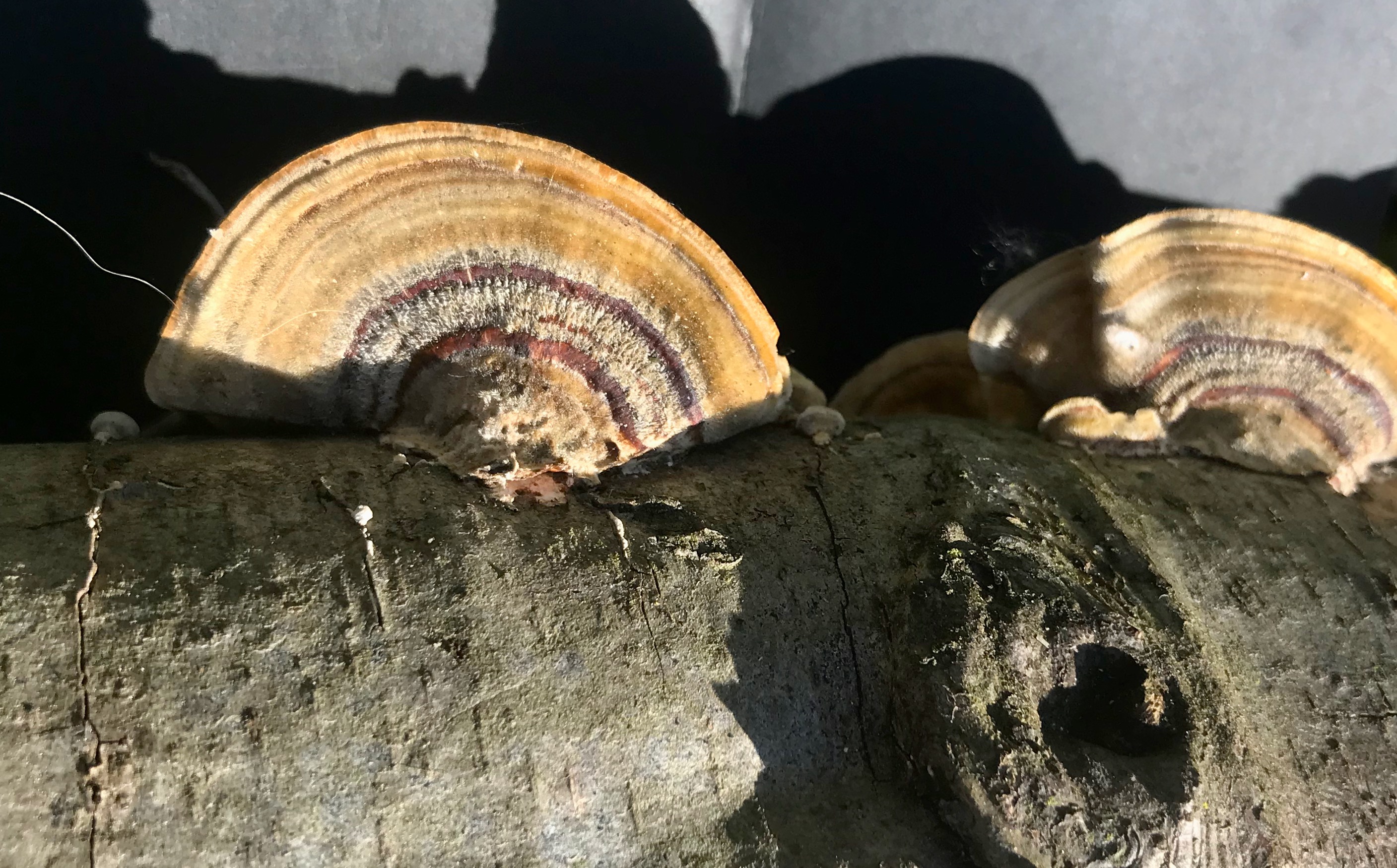
White-lined Sphinx (hyles lineata). As unique sightings go, I observed a few interesting mushrooms, some beetles, and birds, just walking through the space. On one long fallen dried log in an open dry space, remnants of what looked to be Turkey Tail like fungus, long dried and sun bleached, clutched onto the length of tree.


At one location, I used the BirdNET app to ID a Bewick’s wren and a Nuttall woodpecker—both doing their bird thing not too far off the narrow path. Many of the birds that chose to not be seen and stayed at considerable distance from any passersby.
On my way back, I stepped down into an open glade to see how a riparian niche over topped by oaks and tall alder and willow. The floor of which was covered, in some places nearly a feet deep, with fallen leaves and detritus. This space had a magical feel as highly filtered sunlight barely made it through the canopy making the whole space look like a post-card. That magic, however, was disturbed by signs of man’s presence from an abandoned tire and basketball, both slowly being swallowed by the falling organic matter.

Signs of human intrusion on the El Prieto Canyon Trail. These human intrusions to the otherwise natural space were just one example of our presence. On the trail, there were several hikers, people on mountain bikes, and objects lost by both. Of the people on bicycles, many occupied the trail going great speeds which seemed to present a significant hazard to both human and fauna. Personally, I had to dodge several with their fast-approaching sheep bells announcing their presence before coming into sight. I suppose this is just a hazard of the trail and something to watch out for like a horseback rider, bear or, rattle snake.
Lastly, I used this excursion to gather some data as it relates to the different plant communities and in one unique plant patch that encompassed riparian, sage, chaparral, and oak forest which yielded interesting results. In just a short space, plant diversity seemed to explode in a mix of variety and location.
After these surveys I returned to my starting point, checked myself back in and departed for the day.
Field Observations
- Many mountain bikes (in the time of my observations)
- 4 trail hikers
- Bird calls from Berwick’s Wren and a Nutall woodpecker
- Several mushrooms (2 fresh, one set dried)
- Large trash/debris (tire/basketball in creek)
- Poison oak in nearly every cooler/wet space.
- Lots of insect life (diabolical ironclad beetle, gnats, bees, butterflies
- White-lined sphinx caterpillar
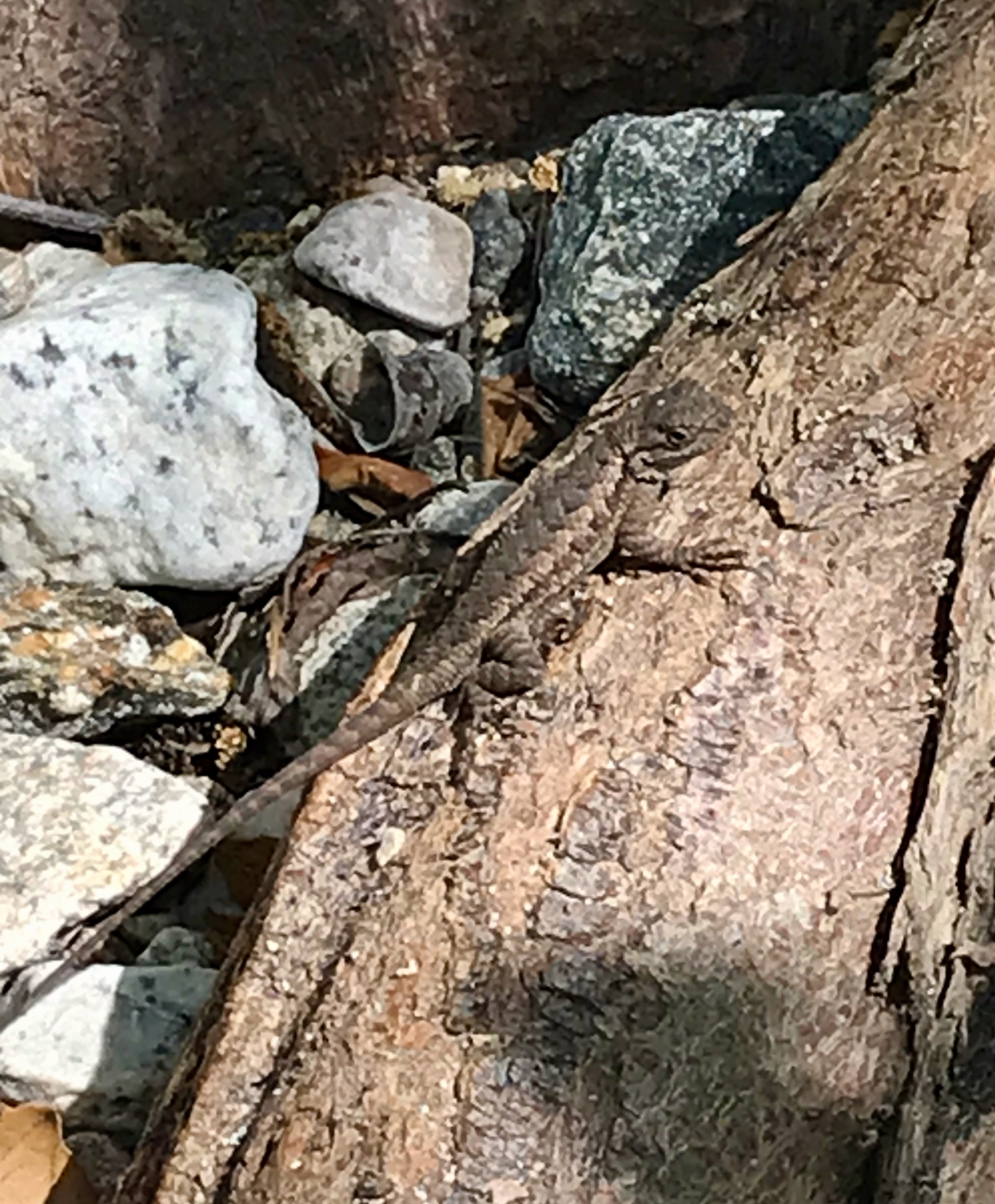
- Many lizards along trails
- Old concrete gabion channel walls (creek flow chokes)
- More exotic plants (acacia and Pacific pea)
- Hemlock in great abundance
- Patch habitat following sunlight/slope paths
- Grasses growing in niche biomes
- Thick detritus leaf mulch
Observed Species
- Alder – Alnus rhombifolia
- Arroyo Willow – Salix lasiolepis
- Ash – Fraxinus genus (non-native)
- Black Sage – Salvia mellifera
- Black Walnut – Juglans californica
- Buckwheat – Eriogonum fasciculatum
- California Sage – Artemisia californica
- caterpillar scorpionweed – Phacelia cicutaria
- Chilicothe – Marah macrocarpa
- Coastal woodfern – Dryopteris arguta
- Common Conecap – Pholiotina rugosa
- Cootmundra wattle – Acacia baileyana
- Desert wishbone-bush – Marabilis laevis
- Diabolical Ironclad Beetle – Phloeodes diabolicus
- Dodder – Cuscuta californica
- Elderberry – Sambucus melanocarpa
- Elm (Chinese elm?)
- Grasses (many)
- Grasses (various)
- Hemlock – Conium maculatum
- Invasive/non native mustards
- Laurel Sumac – Malosma laurina
- Miners lettuce
- Mulch Maids – Leratiomyces percevalii
- Mule Fat – Baccharis salicifolia
- oak(s)
- Pacific pea – Lathyrus vestitus
- Poison Oak – Toxicodendron diversilobum
- streambank Springbeauty – Claytonia parviflora
- Sunflower
- Toyon – Heteromeles arbutifolia
- Weeds (many)
- Western Sycamore – Platanus racemosa
- White-Lined Sphinx – Hyles lineata
-
Upper Arroyo Seco – Visit 3
California Naturalist Outing
Upper Arroyo Park/Trail
JPL Bridge – Millard Canyon
8:50 a.m. – Noon- Route: Entering at the fence line, north. Stopping along the creek, road, and trail.
- Weather: 52°F at start, much warmer at elevation towards noon. Clear after a rain the day before.
- Elevation change: From about 1,100 to 2,000 feet above sea level.
Visit to the Lower Arroyo Seco
Starting out as a group, this trip was composed of approximately 12 members of the biology field class. Together with the professor, we walked a considerable distance as a group (about 2.5 miles) up into the hills in and amongst the sage scrub/chaparral ecosystems. Along the way we traversed through the cool damp riparian creek which was flowing briskly with the rain run-off from the day before, making its way down into the arroyo and out to sea. And through the edging oak forest communities that weave in and out of the sage/chaparral communities, we ventured into.


On this journey, it became increasingly clearer how the edges of one community to another are not fixed boundaries, just as the edges of water and moisture fail to adhere (mostly) to hard fixed edges. Rather, the various “plant communities” tend to blend into one another as benchmark (or keystone?) plants exist in both spaces, dependent on the types of soils, geology, moisture, and sunlight penetrate it. I wouldn’t be surprised to see an area that “should” be a sage community shaded and cooled by an opportunist oak turning what would normally be a hot dry cleft into a small micro-oak forest, assuming the right conditions were met.


Another aspect of the sage/chaparral ecosystem in this configuration was how they tended to cling more to sides of the hills and mountains, rather than existing as flat areas of foliage and mulch, accumulated over many years. To the contrary, the hillsides seemed to have less of that detritus and plant material, most likely washed away by rains, or blown away with the strong winds which seem to be more the norm these days. What was left was on the scrub forest floor would be prime fuel for forest fires that are increasingly plaguing the hillsides of SoCal.
Following the Fern Truck Trail up the hillside, we came across several different and new species in this sage/chaparral plant community. Of those, we encountered monkey bush flowers, hollyleaf cherry, and different types of buckwheat mixing in this intercoastal space. One observation that struck me was how different things grew dependent on its orientation to the sun. Most interestingly were how plant ecosystems on a northern exposure grew up into the higher elevations and on southern exposures, it seemed as though upper ecosystems grew down into those lower. This was all conditional as dictated by invisible geologic formations that could move (or block) water through the landscape creating green zones (or plant community patches). Looking at the hillside in total, these patchwork communities began to stand out as opportunist plants occupied niches and exploited perfect growing conditions for that plant at that time.

Also in the spaces, the birdlife seemed more natural from down in the Lower Arroyo. By that, I mean they seemed less attenuated to people being present and more bird-like in their behavior. Ravens flew without concern of us clumped together on the trail and a turkey vulture turned on the up drafts from the canyons, high overhead.
At the point in the trail we stopped, we had reached about 2,000 feet in elevation. Looking out over the western San Gabriel Valley, we took some time to envision the space over the many millennia of human habitation in the region. Collectively we tried to envision the many cycles of change, from oak forests, chaparral/sage ecosystems and grass savannas stretching out into the distance. Bringing that idealized past forward, our visioning took us through periods of cattle grazing in open spaces, denuding from the growth of ranchos and orchards and agricultural production. In its latest iteration, seeing the vast open space of the valley as a giant urban forest with thousands of trees and shrubs of different species mixed into lawns, building sites, and abandoned or undeveloped spaces filled with native and non-native grasses and weeds (or less desired plants). The thought around this for me was how nearly impossible it was to impose or say what is “a better” ecosystem, especially as both the natural and developed spaces evolve and change with human intervention. Our present-day horticultural practice is no different today than they were perhaps 10,000 years ago as the people in the space tried to shape or control it to fit their needs and requirements at that time.


My conclusion is that there is no “natural” state unless it’s a state without human intrusion. The landscape is shaped just by our presence in it. More so in our assimilating and living off it. That said, I do think there are approximations to natural states, which is what some strive to create when considering natural landscapes. But even then, if not allowing the plants and systems decide what works and what doesn’t, it’s impossible to recreate what nature itself dictates.
Here we concluded our excursion and returned to our point of origin, concluding our time on the trail.
Field Observations
- Mountain bike riders (many)
- High canyon birds
- Mushrooms
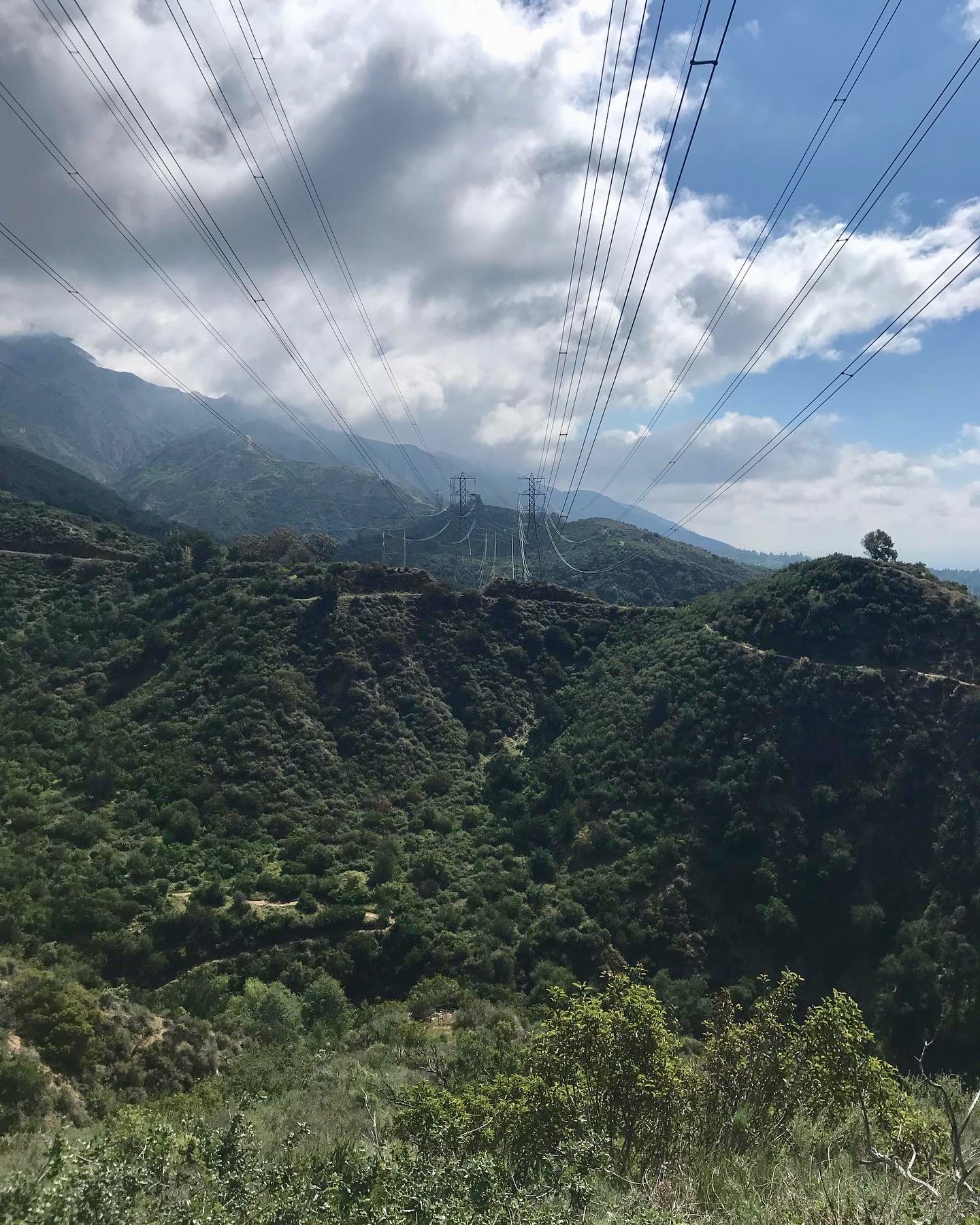
- Radio/transmission equipment
- Electrical transmission towers/lines
- Suburb communities
- Broad views of the western San Gabriel valley
Observed Species
- Hollyleaf Cherry – Prunus ilicifolia
- California buckwheat – Eriogonum fasciculatum
- Coastal buckwheat – Eriogonum latifolium
- Laurel sumac – Malosma laurina
- California Sage – Artemisia californica
- Elderberry – Sambucus melanocarpa
- Southern Bush Monkeyflower – Diplacus longiflorus
- Mushroom – Astraeus pteridis
- Turkey Vulture – Cathartes aura
- Ravens – Corvus corax
- Black sage – Salvia mellifera
- White sage – Salvia apiana
- Hairy Ceanothus – Ceanothus oliganthus
- Chamise – Adenostoma fasciculatum
- Wild cucumber/ Chilicothe – Marah macrocarpa
- Bigelow’s Spike Moss – Selaginella bigelovii
- Sacred Datura – Datura wrightii
- Woolly Indian Paintbrush – Castilleja foliolosa
- Spanish Broom – Spartium junceum
- California Dodder – Cuscuta californica
- Mule Deer – Odocoileus hemionus
- Invasive mustards
- Ground oaks
-
Upper Arroyo Seco – Visit 2
California Naturalist Outing
Upper Arroyo Park/Trail
JPL Bridge – Millard Canyon
9 a.m. – 11:30 a.m.- Route: Entering at the fence line, north. Stopping along the creek, road, and trail.
- Weather: Warm, 70° F, clear with a few clouds very high in the sky. Air was dry.
Visit to the Lower Arroyo Seco
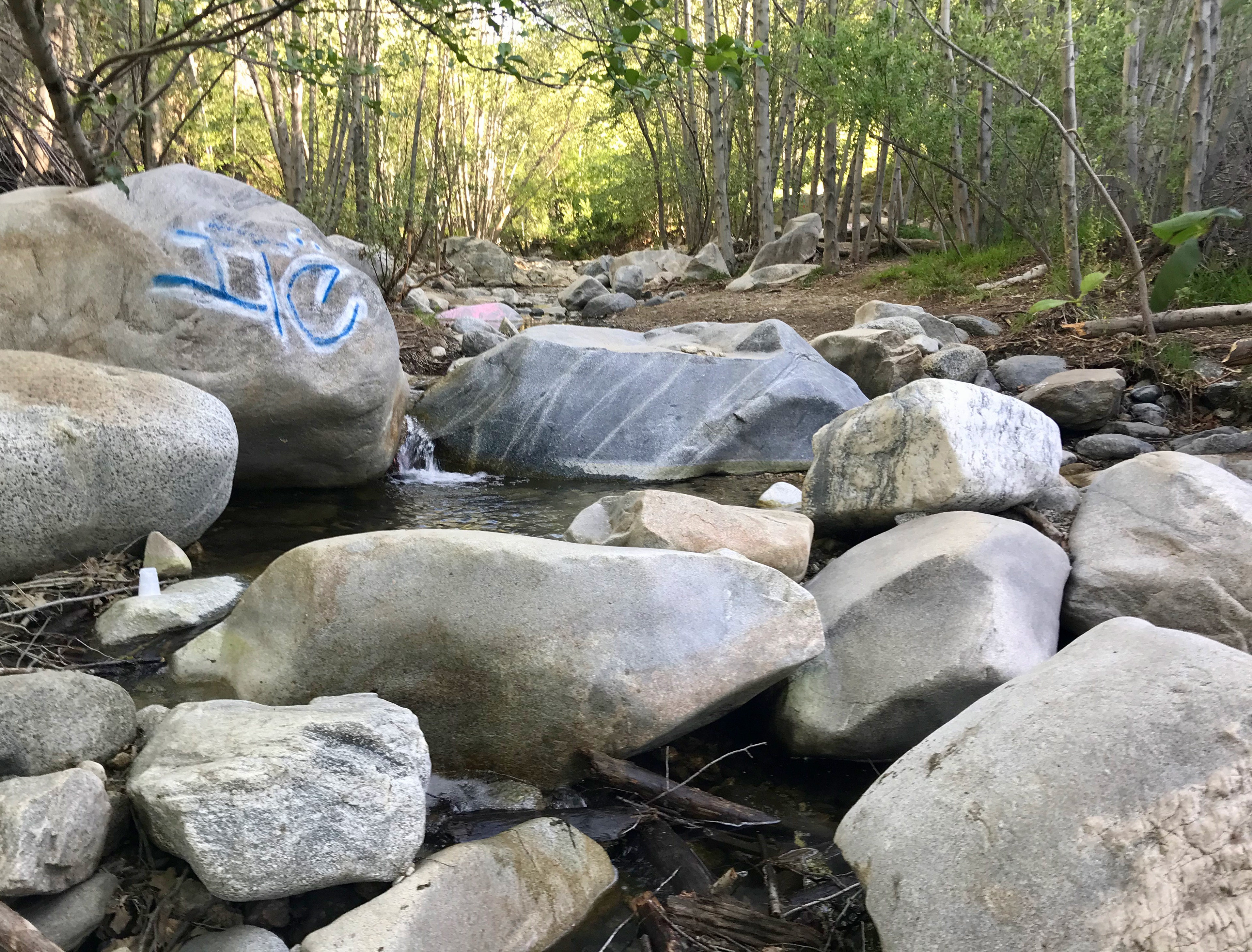
This trip into the Upper Arroyo consisted of a solo adventure along the creek bed up to the third bridge over the creek.
Along the banks of the creek throughout, were a wild mix of California Sage, buckwheat, alders, mugwort, willows, and mule fat. In some stretches, alders lined both banks forming a high ceiling canopy that enclosed the space. Water was consistent from upstream all the way down to the JPL bridge. In the cleft, the air (and water) was much cooler with lots of human activity by way of young (2-3 years old) with adults playing and exploring.

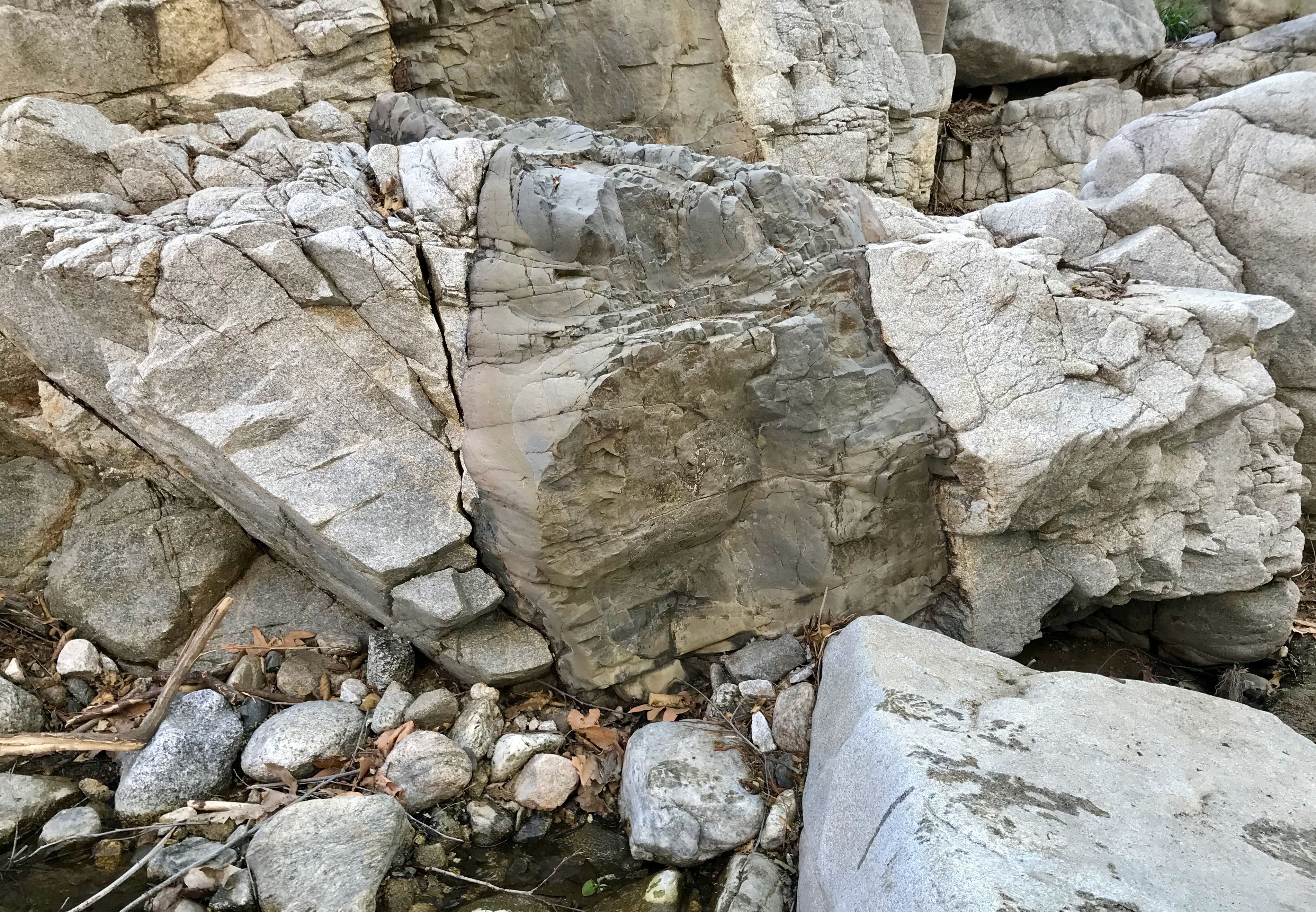
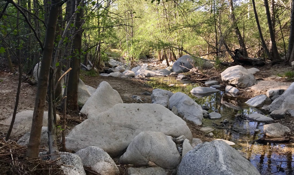
In the creek bed, a huge number of tumbled stones lined the floor while massive boulders edged and hemmed in the water. The various rocks took on a vast array of appearances and forms—from fresh fallen sharp-edged stones to tumbled rocks with rounded edges from years of being pushed downstream from thousands of years of flood events.
The trees, mostly alder, were massive with trunks more that 24 inches in diameter and lots or upper canopy growth. It appeared that many lower limbs had been removed, perhaps by those 100-year flood events of tall rushing walls of water moving into the lower arroyo.

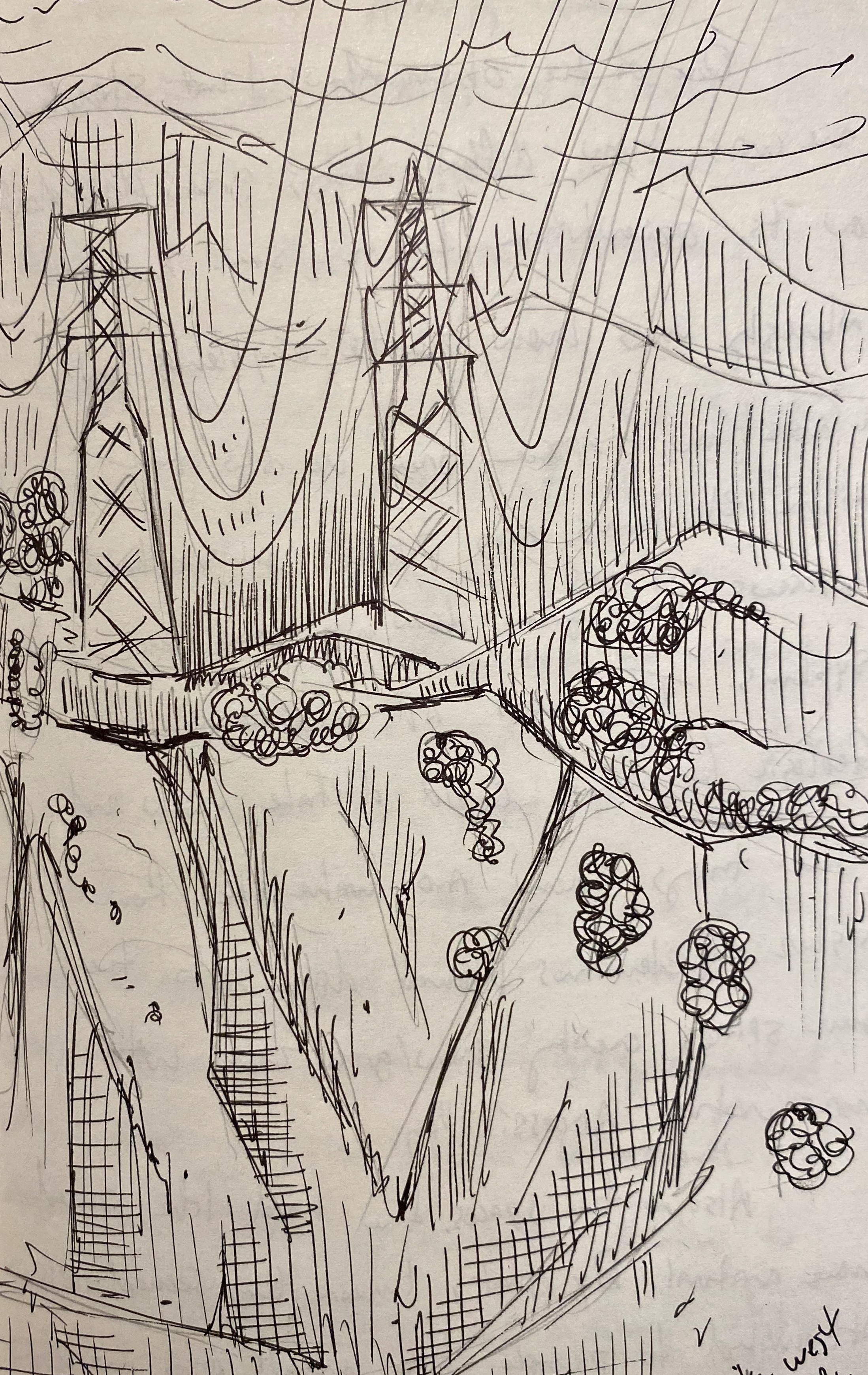
Mixed into the organic and inert stone were hunks of metal—twisted steel from some long abandoned (or lost) development up stream. Most likely, the hunks of metal were the washed-out culverts or similar anthropogenic intrusion into the natural space. Much of it smashed and firmly stuck deep into the gravel and stones, irretrievable without some massive mechanical intervention. Other man-made intrusions were large utility poles stretching power lines up the creek floor to some invisible destination. These massive structures were hidden, to a degree, until you stood below them like towering concrete and steel trees, stark and barren in the space.
Amazingly, life persists in the space with spiders making web holes to leap onto prey, lizards darting to-and-fro on the dry shores, and quail in the higher dry banks under scrub and brush. The riparian creek bed forest was alive and moving as much as the water that flowed through it.


What did strike me was the way people (other the group I was with) were using the space. Throughout there were several hikers, bikers, walkers, and people with young children, essentially using the space as a relaxing and learning lab or natural learning environment. It made me think that people, over the course of thousands of years, could have used places like this as locations of recreation or congregation to just enjoy the space and the bounty in it. Fish, I imagine, would have been plentiful. Fowl and other small prey along with water dependent plants for resources and food, used in daily life would have been more readily abundant in the upper reaches of the canyon. All-in-all, the Upper Arroyo would likely have been as popular back then as it is today, if not more so with native plants and animals in greater abundance without all the larger scale human interventions in the space and downstream. In the space itself, the atmosphere was calming in a way I’m sure it has been for millennia.
Reaching the second bridge, the riparian creek took a slightly different tone as the space broadened and more sycamore, sage and buckwheat encroached on the willow and alder edges along the eastern side. At around 10 a.m., the creek bed past the second bridge was still in deep shadow as the rising sun hadn’t over-topped the canyon wall making the space much cooler and hospitable an otherwise dry, full sun plants. Sycamore became the more prevalent and other more unique species had a presence including nightshade, castor bean, catch weed, snake root, reed seed plantain and a variety of grasses and weeds (including poison oak).

Broadly, it was a healthy space with many flying insects, hover flies, birds (like canyon wren) stink bugs and fence lizards around every turn.

Looking up into the riparian creek up into the space beyond the third bridge. Along the path to the third bridge, the creek widened, and the plant diversity exploded with sage scrub/oak forest and riparian ecosystems blurring into one another. That blurred line of hard edges likely had to do with the changing microclimates of the landscape through various parts of the day and time of the year. The slope and angle of canyon wall acting as a climate buffer shielding the sensitive plants from the strong sun at times and then giving a perfect keyhole of solar illumination to others in just the right quantity when they need it.
Just past the third bridge, I met a lizard, a carpenter bee, and a stink bug all within 30 feet of one another and in a spot without much human activity, likely leading to the wildlife’s willingness to not take cover as quickly as those downstream.


It was here that I ended my exploration and made my way back to the parking lot and concluded this trip into the Upper Arroyo Seco.
Field Observations
- People, young children, in learning groups or with parents
(and toys) in and along the creek. - Man-made elements, hidden in plain sight:
- (poles, culverts, stacked stone retention walls)
- Rocks: sand, gravel, fist-sized, boulders, massive car sized stones.
- Some tumbled (rounded/smooth edges)
- Some part of a larger conglomerate mix with intrusions.
- Many with different geologic formations and appearances
- Riparian ecosystems blending in and out of oak and sage chaparral forests
- Diverse: animals, insects and birds
- Tall and thick alders, oaks, sycamores through-out the space.
Observed Species
- California Quail – Callipepla californica
- Fence Lizard – Sceloporus occidentalis
- Canyon wren – Catherpes mexicanus
- Willow Apple Gall Sawfly – Euura californica
- Desert Stink Beetle – Genus Eleodes
- Sticky snakeroot – Ageratina adenophora
- Armenian Blackberry – Rubus armeniacus
- Trailing blackberry – Rubes ursinus
- Redseed plantain – Plantago rhodosperma
- American Nightshade – Solanum Americanum
- Western Sycamore – Platanus racemosa
- California Sage – Artemisia californica
- Buckwheat – Eriogonum fasciculatum
- Spider – unknown funnel weaver
- White Alder – Alnus rhombifolia
- Mule Fat – Baccharis salicifolia
- Grasses (variety)
-
Upper Arroyo Seco – Visit 1
California Naturalist Outing
Upper Arroyo Park/Trail
JPL Bridge – Millard Canyon- Route: Entering at the fence line, north. Stopping along the creek, road, and trail.
- Weather: 54° F at start. Clear blue sky, dry air, crisp but fast warming.
Visit to the Lower Arroyo Seco

Looking north into the Gabrieleno Trail at the Millard Canyon entrance. This was our first excursion up into the Upper Arroyo as a class. The goal of this outing was to observe the space, look at the similarities and differences of plant communities and to try and see the space as a mosaic of patches, a “landscape ecology.” Part of that process included visually analyzing the percentage of coverage of species and naming “patches” by the three most common species in a patch, starting with the most dominant species and descending to the least. I.E.: Patch name: first species, second species, third species. This becomes clusters of species to create a mosaic.

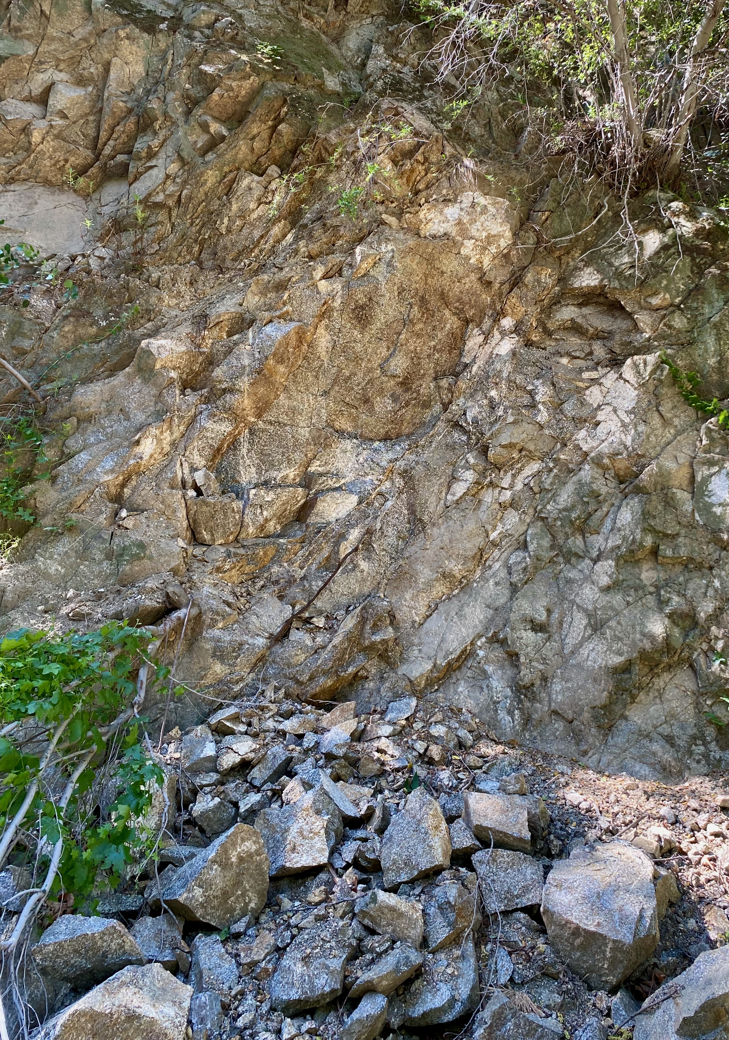
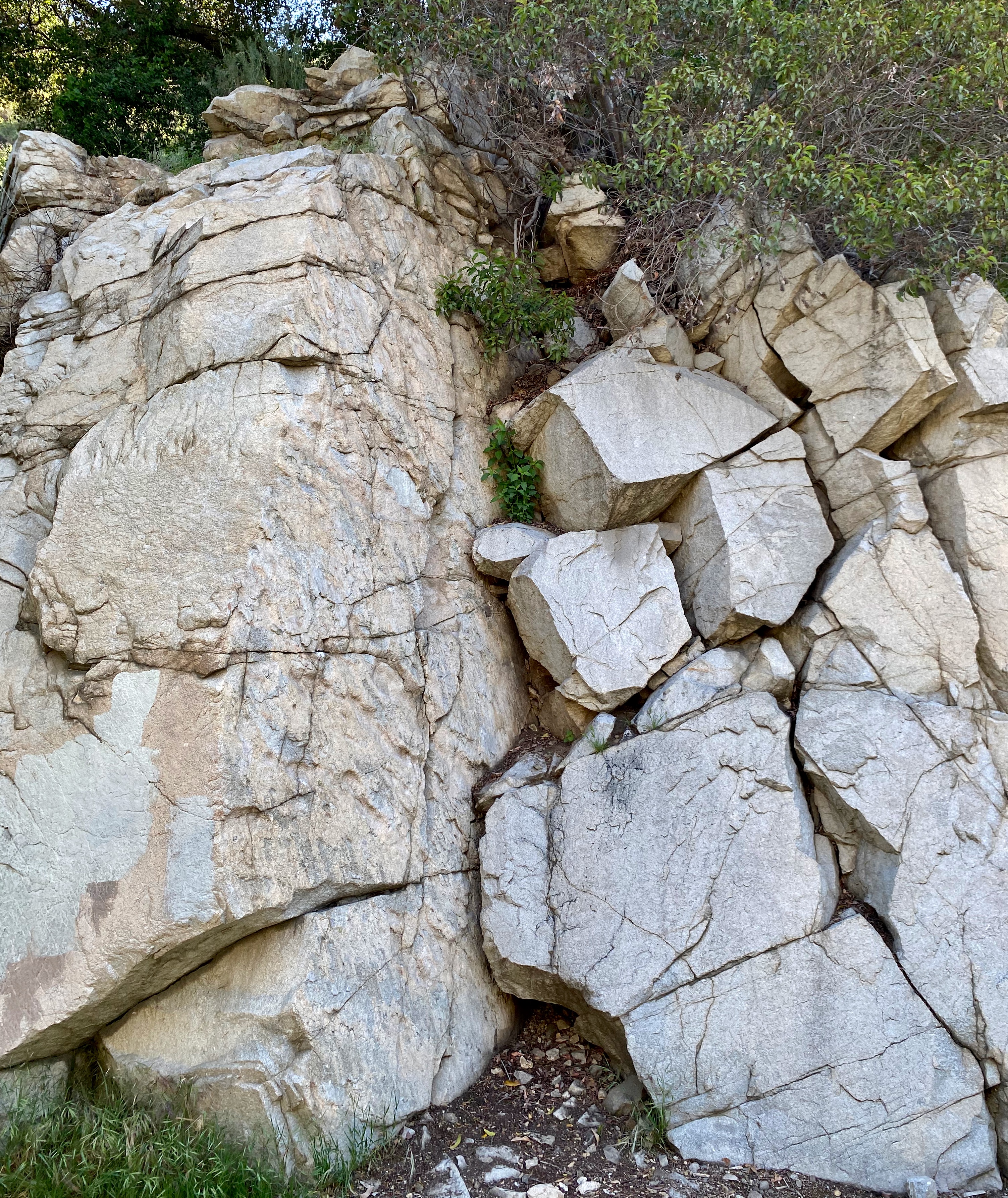
Looking south on the south side of the JPL bridge. The location is a geologically interesting one with faults and multi-level ground morphology creating pools and running streams of water coming down from the hill into deep channels of bedrock filled with sand and gravel that snake their way down into the Los Angeles river basin along the Arroyo Seco. At the trail head, the RockD app shows late cretaceous Granitic rocks, leucocratic granodiorite pushing, fracturing, and breaking down into the sand and gravel filling the Devil’s Gate dam.
The space has an interesting history entwined with the space race and the (infamous) rocket scientist Jack Parsons who launched solid rockets in the in the wide shoals of the arroyo. Those tests, and barrels of jet fuel dumped into the, then, mostly empty riverbed creating a modern day federal super fund clean-up site (along with cancer hot spots from polluted ground water). Percolates, a cancer-causing chlorine-oxygen molecule, is a salt and used as an oxidizer for pyrotechnic devices has been found in the deep ground water run-off from the hills and picked up in the, now clean, riverbed.
Much lie the Lower Arroyo, the upper is dynamic and historical site with its own ecological history and anthropogenic impacts from past and present manipulations. When measured in geologic time it is but one small effect in a much longer process (non-the-less toxic to human).

Looking south in the riparian creek bed of the Upper Arroyo Seco park trail. Broadly, as a class we discussed the many natural effects on the region from fires, floods, people, and earthquakes, it very much took on the mantle of a dynamic environment—one that is always changing and moving (growing, burning, shaking and falling).
Immediately at the creek, willow, alder, and mule fat populated the edges, crisscrossing the moving water and creating an organic canopy of tree limbs and leaves overhead. Further up, oaks, sycamore, sage and buckwheat dotted the canyon walls with walnut, ceanothus and yerba santa (the latter being edible, the taste reminding me of a dentist’s office).


Taken in total, the Upper Arroyo is very much a wild space but with a wide breadth of human adaptation and use (and re-use) with a significant presence over the last century.
Field Observations
- Lots of kids in outdoor schools.
- Old roads, rock walls, trails, and small buildings.
- Many mountain bike riders
- Dramatic slope effects
- Patchwork plant communities
- A vast number of tumbled stones, from very small to very large
Observed Species
- Buckeye – Aesculus californica
- Poison Oak – Toxicodendron diversilobum
- Black Sage – Salvia mellifera
- California Sagebrush – Artemisia californica
- Laurel Sumac – Malosma laurina
- Elderberry – Sambucus melanocarpa
- Yerba Santa – Eriodictyon crassifolium
- Black Walnut – Juglans californica
- Toyon – Heteromeles arbutifolia
- Arroyo Willow – Salix lasiolepis
- Alder – Alnus rhombifolia
- Mule fat – Baccharis salicifolia
- California Quail – Callipepla californica
- Grasses (various)
-
Lower Arroyo Seco: Visit 6
California Naturalist Outing
Lower Arroyo Seco Park
Pasadena, CA
8:50 a.m. – 11:45 a.m.- From the Rose Bowl Parking Lot (south side) near the aquatic center.
- Route: Footpath along the road to the trail head.
- Weather: Clear skies, warm, 72°-74°F at start, mid 80s°F at end. The air felt hot in the sun.
Visit to the Upper Arroyo Seco
This trip was different than the previous ones as I sought to observe and note examples of local geology, human activity (past and present) and the use of the landscape by past indigenous peoples.
Also of interesting note, I followed the trail on the west side of the creek down to a point past the archery range and the La Loma Street bridge. Along that trail, I noticed many instances of what looked like old plantings of native species and many new (and old) examples of infrastructure put in place for one purpose or another. Observationally, it made for an interesting mix of very old, somewhat old, and new objects with both obvious uses and more obscure ones lost to time.
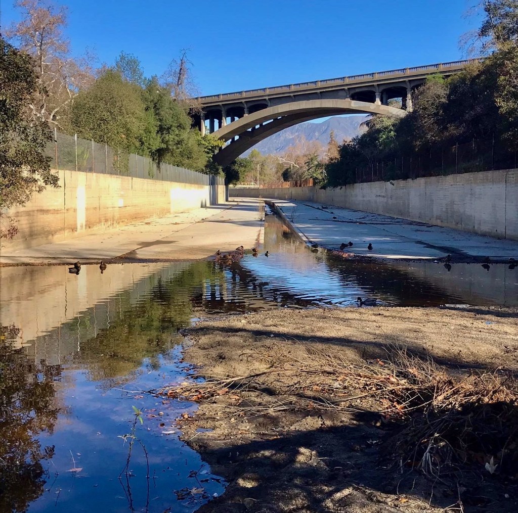
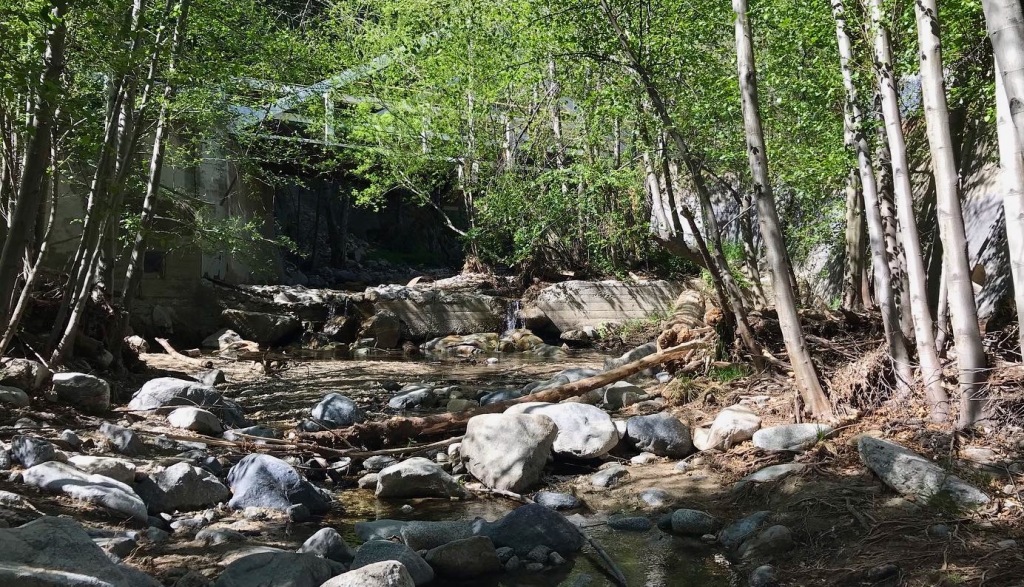
Lower Arroyo Park, looking north, where the concrete channel meets the riparian creek bed. I started the excursion at the riparian creek side to take in the environment. Week to week I can see how things have changed in large and small ways. Small, such as trash and detritus debris from water releases down the channel, animal carcasses that are there one week and gone the next and other trash debris that moves with the flow of water and people in the space.


In this space, the presence of longer-term human impact is harder to see once you travel 20 yards from where the concrete water channel ends and the natural space begins. You can see the same, further down at the dam and spillway and at the larger bridges that span like giant cliffs up into the sky. These are definitely “man-made” objects and fit the anthropogenic definition of human placement in the space. And yet, they exist in the same way mountains do—monolithic, unmovable, and stoic. They exist and impose themselves in a way literally shapes the space around them. Manmade but beyond simple comprehension.
The riparian space in the Lower Arroyo is full of human made objects with concrete conglomerate cast-offs. Trash and daily life ephemera–masks and food containers abound here. Mixed into this matrix are leaves, logs and other “organic” leftovers and cast offs.

Under the 134 Freeway in Pasadena. Of note in the space, was the geologic composition under the creek. RockD lists it as Quaternary/alluvium – old unit 3, late Pleistocene. In makes sense given the aspect of flowing water and the ability to send it into aquifers or at least down into the soil. It may not be much, but it’s better than letting it (now) run off into the sea.
Walking the space, I was pressed to grasp fully how past indigenous peoples would have used it year-round. My conclusion was that they wouldn’t have. The riparian creek side would be a great fishing spot when fish were running. It would have also been a nice place to escape the heat or gather water. The vegetation would also be good sources for building or crafting materials (reeds, staves, ETC.). Also, as places to bathe, track and trap animals who come down to drink from the edges.
Following the creek, I crossed at the flat wash under the 134 freeway. On the west bank. I followed the creek down to the dam finding several new plants, not observed on more park like east side. This space was much more “natural” and less manicured. Plus, it seemed to represent more of the natural look and feel with oak forest and sage scrub mixing and mingling together. Some of the interesting plant species I found here included a Turkey-tail fungus, a coastal prickly pear cactus, both nestled out of view from a common path.

Further down this path, the geology turned into Mesozoic biotite, firmer and older then in the more vegetive riparian area further north. The strata under the surface were likely less eroded and deep, not collecting as much sand and small stone run-off.
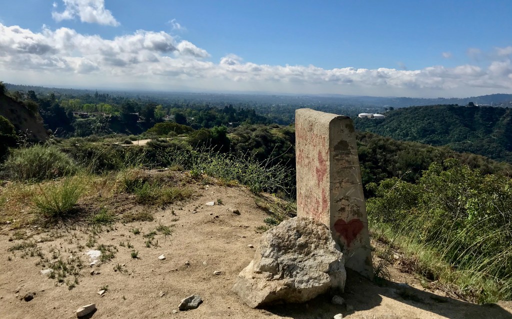
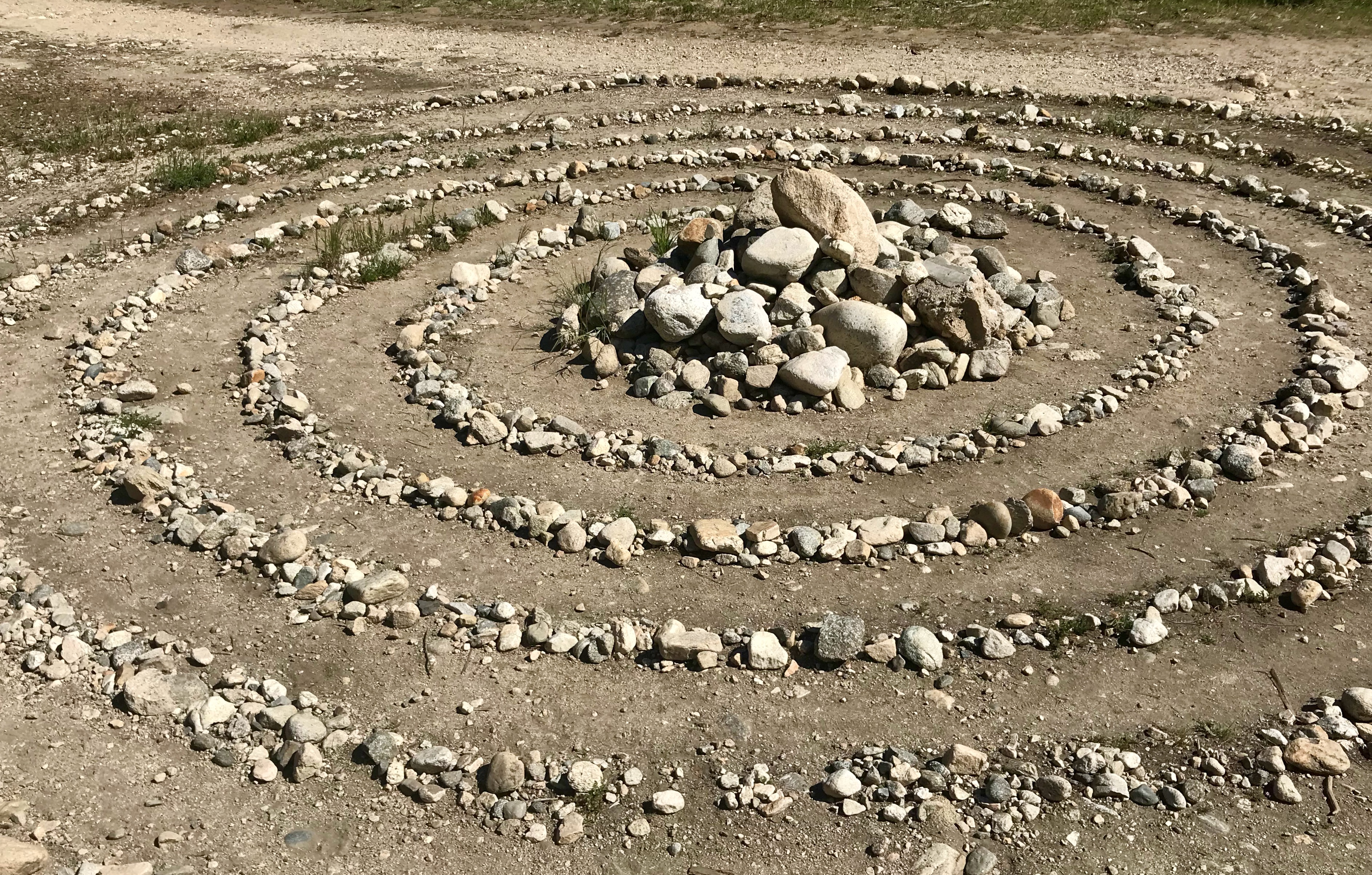
This path, from the dam down the trail to the archery range was a mix of chaparral and oak nestled between meadows along a meandering path along the western bluffs. Both above and below were signs of human occupancy jutting out from the ground. On one spot, old river rock walls and rail boulders snaked along the trail. In others, new post erected by Boy Scouts marked an empty archery range. And yet more in this space, relics of old constructions for unknown buildings sit hidden from view from the trail but scrawled with graffiti telling us we’re moving into “Wendy’s World.”


Not much father along the path were more modern monoliths including a spiral maze arranged out of found and collected rocks, hearts and a smiling face. All could have been days old or the productive of some creative force from millennia ago. One can’t help to wonder if those same activities parallel those indigenous peoples from centuries past—spending idle time in the canyon between foraging or moving between spaces.


That movement seemed to be the dominant feeling in the Lower Arroyo park. The space is anything but static: birds darting to-and-fro, lizards scurrying into brush and detritus, pack rats skulking about, all while larger animals hide in shadows to escape the midday heat or travel through and above the arroyo on monolithic bridges spanning the gap. The Lower Arroyo Seco was alive and abuzz with life and the movement of life within it.
Field Observations
- Riparian/chaparral/oak Forest ecosystems
- West Arroyo wall, many more bird and plant species (a much greater diversity)
- Old stone walls/roads, architecture without buildings
- New and not-so-new archery posts
- Far fewer people than on the east side
- More park-like infrastructure:
- Steps
- Fountains
- Hay bales (archery range)
- A trail cam
- Many man-made arches in the space (bridges) spanning the park.
Observed Species
Observed Plants
- Black Mustard – Brassica nigra
- California Buckwheat – Eriogonum fasciculatum
- California Buckeye – Aesculus californica
- chapparel bush-mallow – Malacothamnus fasciculatus
- Chapparel Whitethorn – Ceanothus leucodermis
- Coastal Prickley Pear – Opuntia littoralis
- Elderberry – Sambucus melanocarpa
- Horehound – Marrubium vulgare
- Hummingbird Sage – Salvia spathacea
- Laurel Sumac – Malosma laurina
- Lemonade Berry – Rhus integrifolia
- Poison Oak – Toxicodendron vernix
- Spiny Redberry – Rhamnus crocea
- Sugar Bush – Rhus ovata
- Toyon – Heteromeles arbutifolia
- Turkey Tail Mushroom – Trametes versicolor
- White Sage – Salvia apiana
- Wild Cucumber – Chilicothe Marah macrocarpa
- Oak Trees several/various
- Weeds (many)
Observed Animals
- California Thrasher – Toxostoma redivivum
- California scrub jay – Aphelocoma californica
- House wren – Troglodytes aedon
- Hover flies Mosquitos Rabbits Sparrows
- Western fence Lizard – Sceloporus occidentalis
- Woodpecker – Melanerpes formicivorus(?)
- Gnats
-
Lower Arroyo Seco: Visit 5
California Naturalist Outing
Lower Arroyo Seco Park
Pasadena, CA
9 a.m. – 11:30a.m.- From the Rose Bowl Parking Lot (south side) near the aquatic center.
- Route: Footpath along the road to the trail head
- Weather: Cold, 54°F, overcast and damp. No rain at visit time but signs of rain were everywhere.
Visit to the Upper Arroyo Seco
This trip was on a day class had been canceled.
The weather had been bad, but my own oversight failed to check the class email. Seeing no other class members, I opted to stay to naturalize in the adverse weather. On this trip my goal was to observe the oak forest and sage/chaparral meadows. The ravens were out and swooping about. Grass was growing taller and seeming more pronounced than previous trips. In the sage meadow, the soil seemed dry and compact in places, as though the rain never reached it. Hair or web like mats showed signs of moisture in-between buckwheat’s.
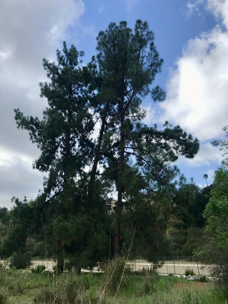
The tall pines of the Lower Arroyo Seco in Pasadena. 
One of several large pines deep in the lower Arroyo Park in Pasadena. Near the restoration plots, black mustard can be seen, beginning to colonize and invade. The tall Ponderosa pines stood over the lush meadow. Everything green was dewy and damp. Nestled in the grass was a single yellow field cap mushroom.
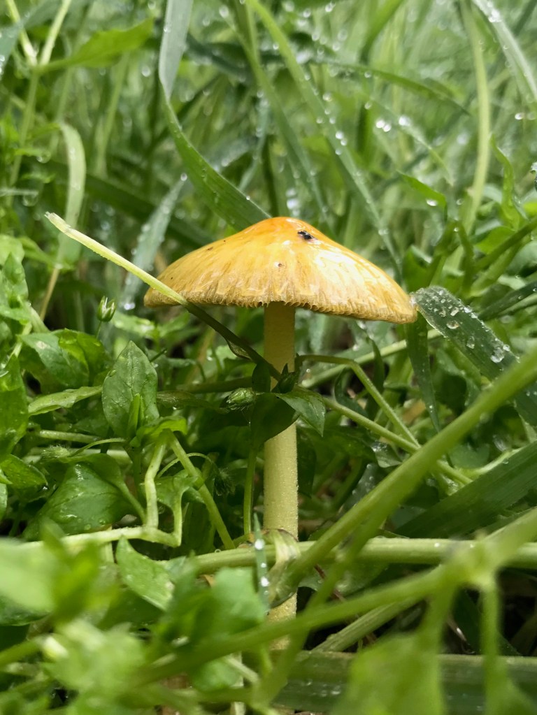
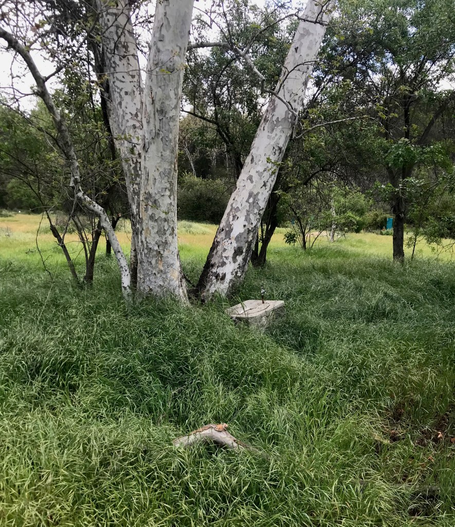
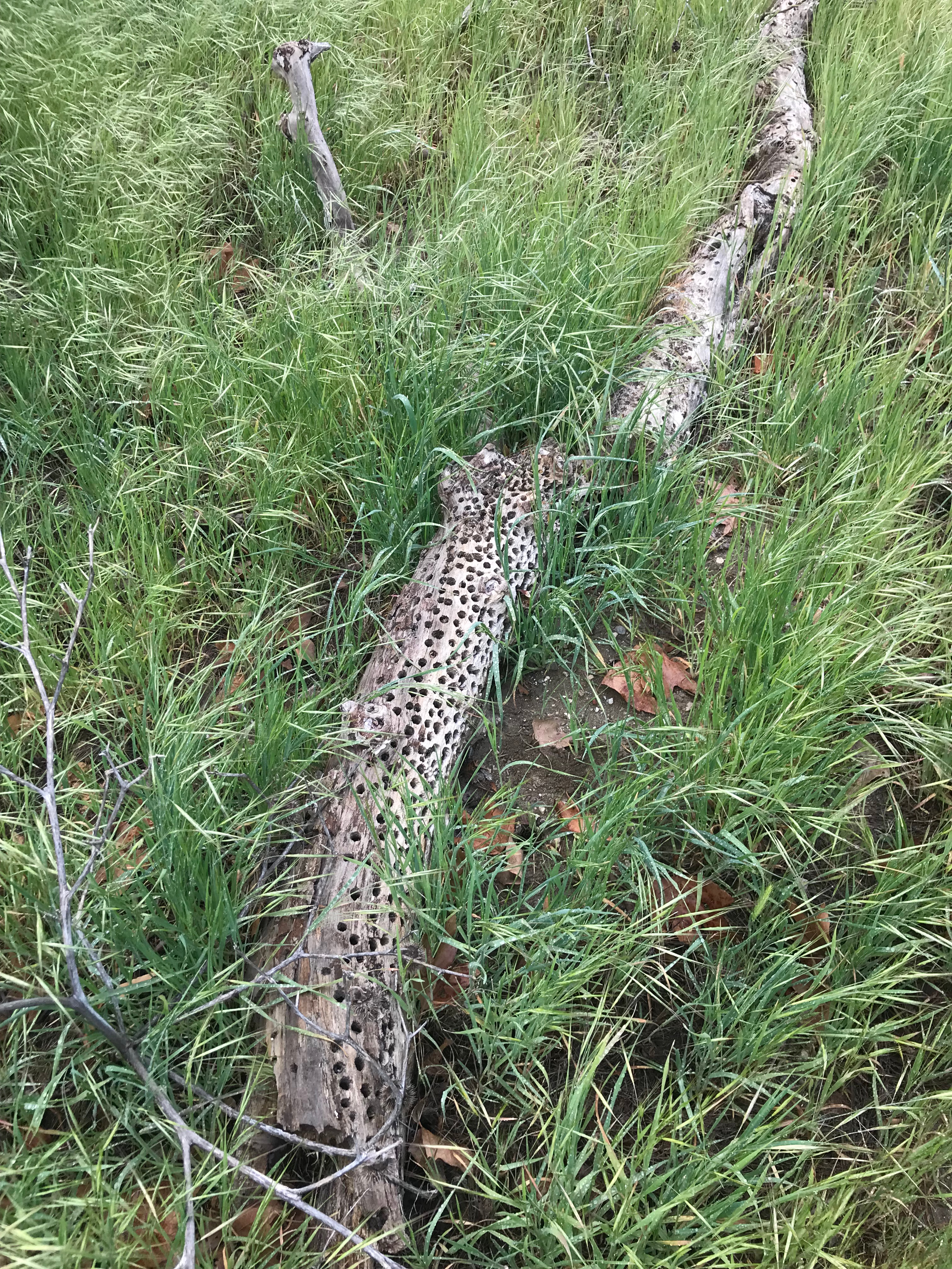
A yellow fieldcap mushroom (Bolbitius titubans) nestled in the wet grass after a rainstorm in the Lower Arroyo park in Pasadena. Further on in the field, was a host of oddities: mounds of soil, an old concrete drinking fountain and an old tree limb covered in woodpecker holes and filled with acorns. In the sky, a raptor drove the other birds and to alarm as it flew and perched high in the trees.
A water fountain in the sage chaparral field in the Lower Arroyo park in Pasadena. 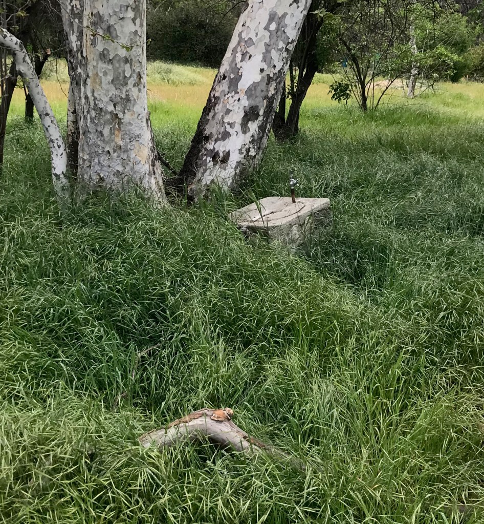
An old water fountain nestled in the grass against a sycamore tree in the Lower Arroyo in Pasadena. As human pollutions go, I was surprised by the number of noises in the space. Air leaf blowers, lawn mowers, cars, horns mixed with winds and bird calls. It made for a cacophony in the still canyon.
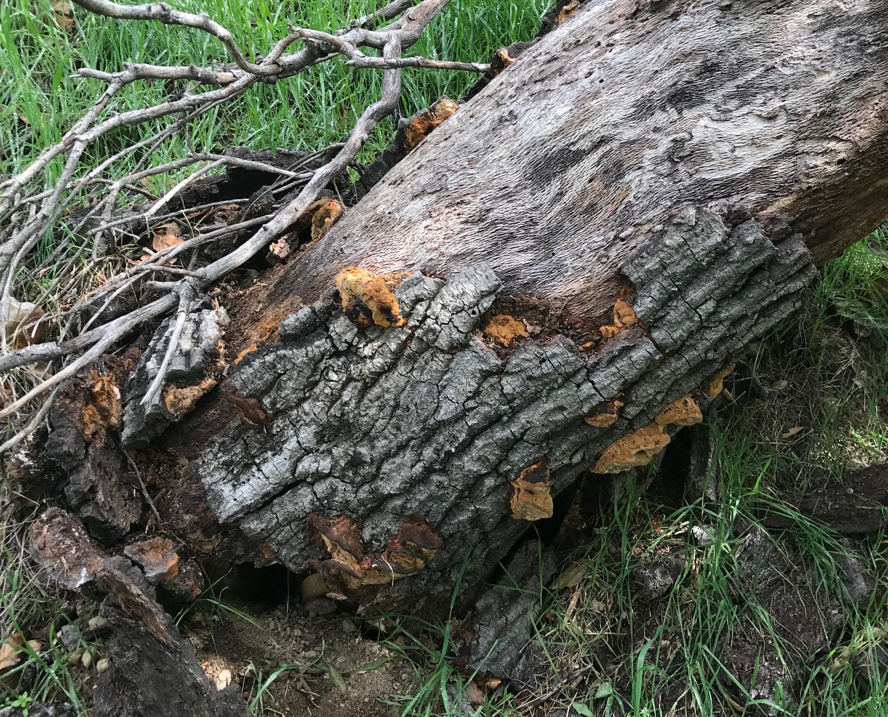
Moving back up the trial, I spent some time in the oak filled space along the east canyon wall. Among the oaks I observed a hard brown fungus on a felled, but still living, oak, a hard mustard yellow polypore as it appeared to me.
Further up, in a slight dry slough, or vernal pool, along the east wall, I noted a pack-rat mound nestled among poison oaks and young sycamores.
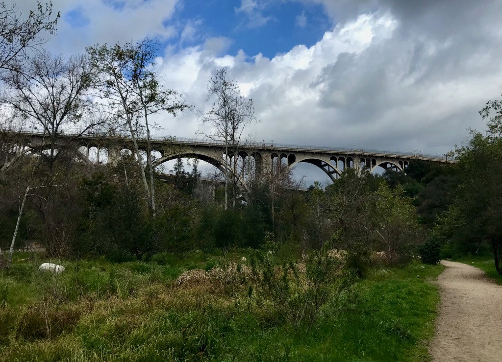
Looking north at the Colorado Street bridge in Pasadena, Ca. Field Observations
- Tall Ponderosa pines
- Oaks
- Sycamores
- Buckwheat
- Grasses (various)
- Old debris
- Fallen limbs
- Birds (raven, hawks, sparrows)
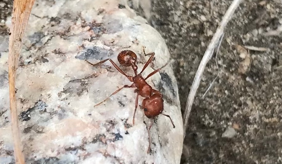
- Ant colony
- Fungus
Observed Species
- Mustard yellow polypore – Fuscoporia gilva
- Yellow fieldcap – Bolbitius titubans
- Sugar bush – Rhus ovata
- California Buckwheat – Eriogonum fasciculatum
- Common Raven – Corvus corax
- California Harvester Ant – Pogonomyrmex californicus
- Grasses (various)
-
Lower Arroyo Seco – Visit 4

California Naturalist Outing
Lower Arroyo Seco Park
Pasadena, CA
8:50 a.m. – 11:45 a.m.- From the Rose Bowl Parking Lot (south side) near the aquatic center.
- Route: Footpath along the road to the trail head
- Weather: Started-out overcast, 54°F. Felt cold, with a breeze. Air was humid. Sky was overcast with a slight drizzle. Rain fell hard at 11 a.m. for approximately 5 minutes.
Visit to the Upper Arroyo Seco
This was the fourth trip into the Arroyo with the goal/purpose to observe and broadly measure the different species in several biomes.
At the first turn down the trail in the wild space, I ventured into the riparian creek to take in the space. Once on the creek floor, I could smell what seemed to be a skunk spray (which could have been the scent of marijuana from someone I encountered in the space). Exploring around, I found the carcass of a rended skunk that looked to be about a day or two old. It was mostly intact with some visible but rotting wounds. Closer investigation found maggots inside the body cavity already beginning to break the carcass down.
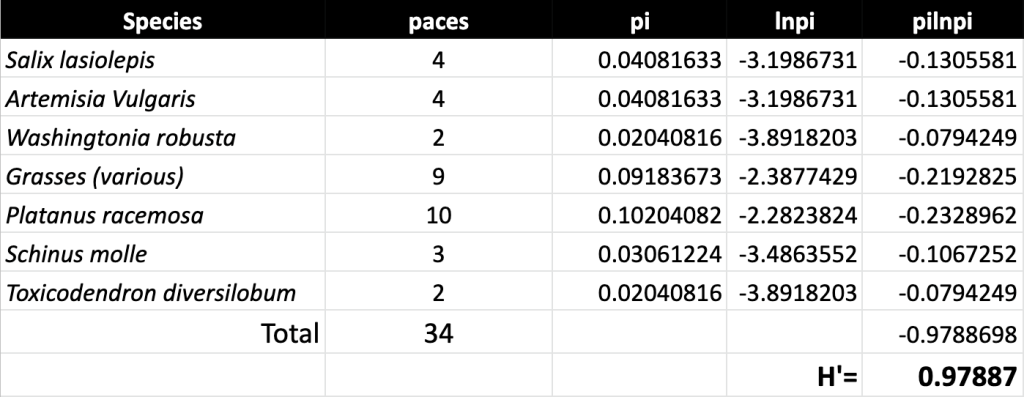
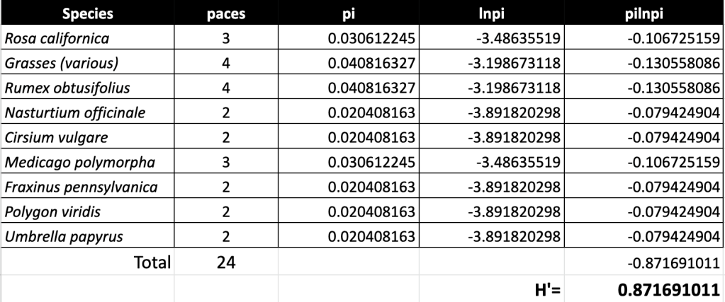
I walked the creek to get a rough estimate of species, finding 7 different species in 34 paces.
Riparian Species Count
Moving further down the trail, going under the 134 and Colorado Street bridge and over the dam, I moved into the meadow space. In this space was a proliferation of grasses and “weeds” and a strange mix of topicals, all growing into one another.

The space itself was a raw mix of “wet” meadow and rough riparian, bordered by oak banks. There was a tremendous number of species in the space with lots of diversity, lots of bugs and lots of birds. Throughout were a few cut stumps and spongy soil. Along the sides were oaks, sycamore, laurel sumac and wild cucumber. All of this beside a sterile concrete channel to sluice the water down channel. In a very few of paces, I encountered several plants and trees.
Meadow/Creek Species Count
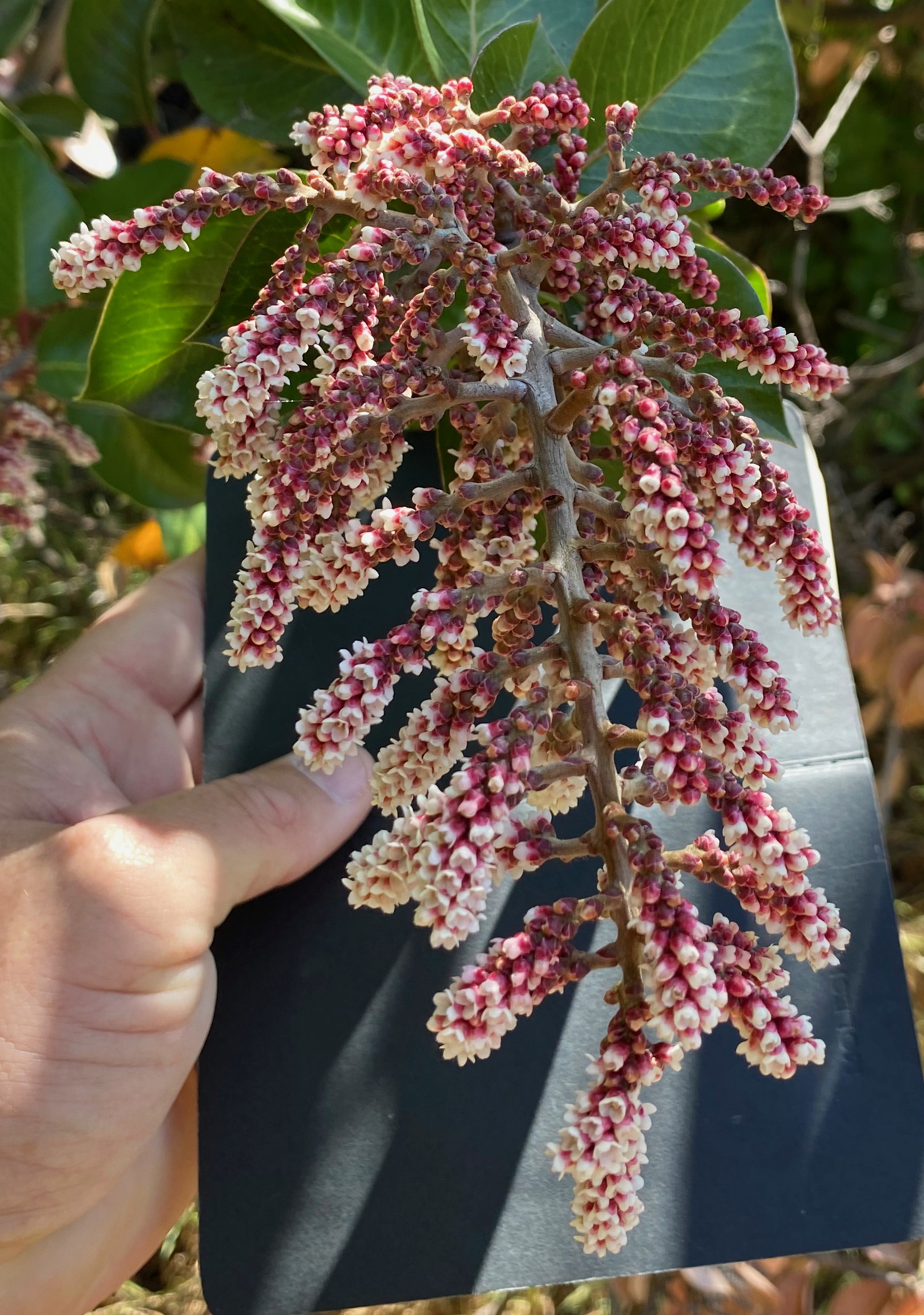
Up from the creek, I moved into the oak forest and chaparral. Everything was in full spring mode with new green growth and lots of grass and nettles coming up. This area was more a mix of willow and sycamore but now with oaks on the sides in the dryer soils. Interestingly, palm trees (massive) eucalyptus (large and old) and very dry old chaparral. In the restored or refreshed creek bed, the remains of snails sit just on the surface of a very dry channel. Black mustard was starting to colonize and make itself known with some early bloomers. On the bank were old growth chaparral of California sage (Artemisia Californica) and buckwheat (Eriogorum fasciculatum). The soils on the bank with the chaparral was very dry and rocky. Across from this chaparral was a hybridized sugar bush/lemonade berry that was giant (over 10 feet tall) with what looked like a packrat den underneath. Surrounding this bush was a number of yellow currants, grasses, mule fat and laurel sumac as well as huge old sycamores.
Further down the trail I moved into the true chaparral which is a vast open space of buckwheat and sages (on the edges) with very dry soils. Gophers are king here with mounds and moved earth nearly everywhere. Game trails crisscross the space with bare soil treads boarded by grasses. There was far less diversity here and fewer bugs and birds. Trees are still present but larger blue elderberries edge small stinging lupines and mule fat.
Sage/Chaparral Species Count

Significant rain began to fall at this point, and I decided to end my observations for the day.
A suspected hybrid sugar bush/lemonade berry – Rhus integrifolia × ovata, located in the Lower Arroyo Seco park in Pasadena. Field Observations
- Transitional spaces blur and blend as habitat mix
- Animal life is present but not obvious (signs but not seen)
- Interesting things in the trees: cucumbers and galls
- Human presence less obvious in spaces down channel

A Live Oak Apple Gall Wasp – Amphibolips quercusinanis on an oak tree in the Lower Arroyo Seco park in Pasadena. 

Observed Species
- Western Sycamore – Platanus racemosa
- Bermuda buttercup – buttercup oxalis
- Mexican fan palm – Washingtonia robusta
- Peruvian Pepper tree – Schinus molle
- Stinging Nettle – Urtica dioica
- Poison Oak (sumac) – Toxicodendron vernix
- Sweet Pittosporum – Pittosporum undulatum
- Umbrella Papyrus – Cyperus alternifolius
- Mugwort – Artemisia vulgaris
- Skunk – family Mephitidae
- California Wild Rose – Rosa californica
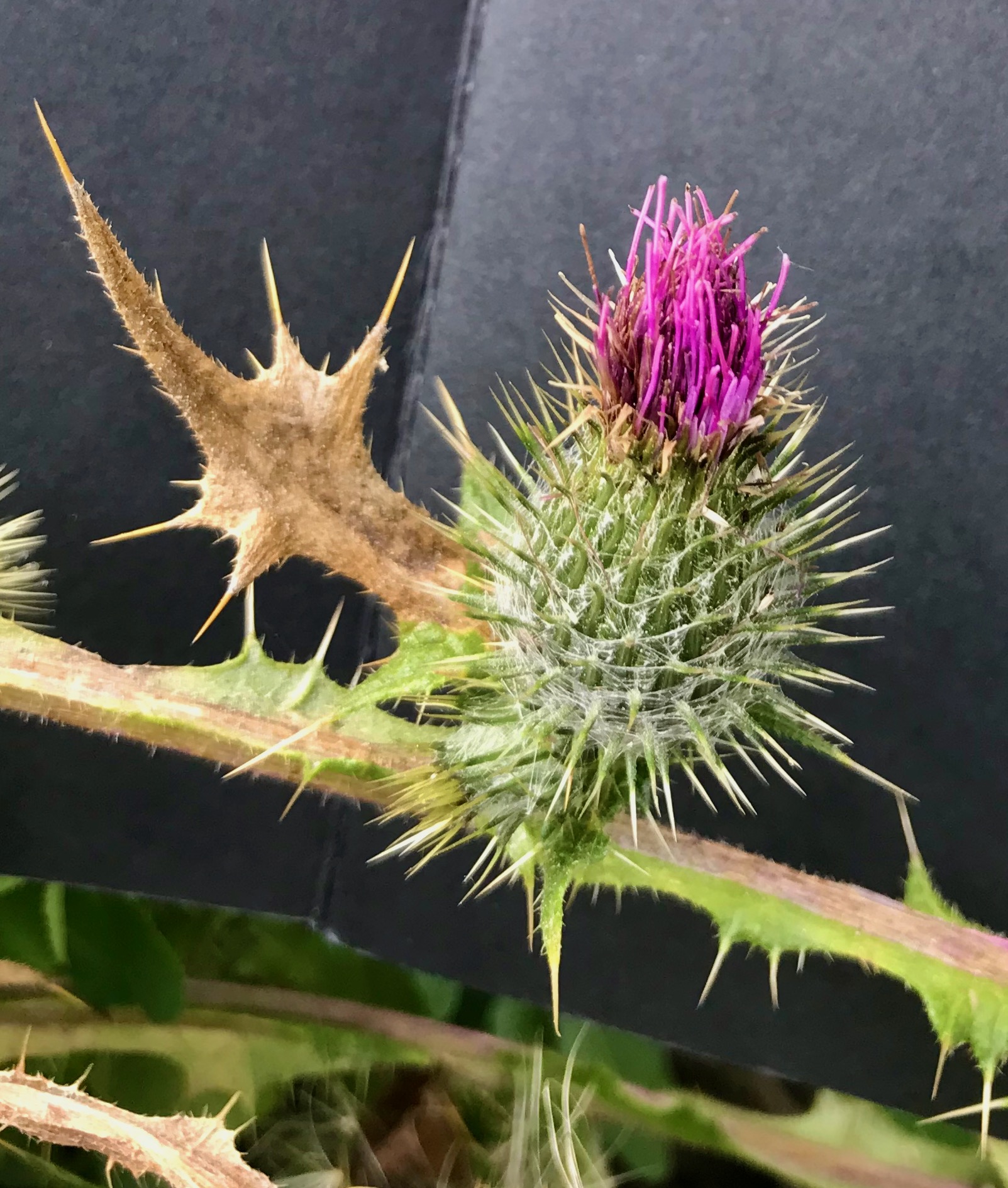
- Bull Thistle – Cirsium vulgare
- Live Oak Apple Gall Wasp – Amphibolips quercusinanis
- Black mustard – Brassica nigra
- Hybrid sugar bush/lemonade berry – Rhus integrifolia × ovata
- California Buckwheat – Eriogonum fasciculatum
- California sage – Artemisia californica
- Prairie Flax – Linum lewisii
- Mule fat – Baccharis salicifolia
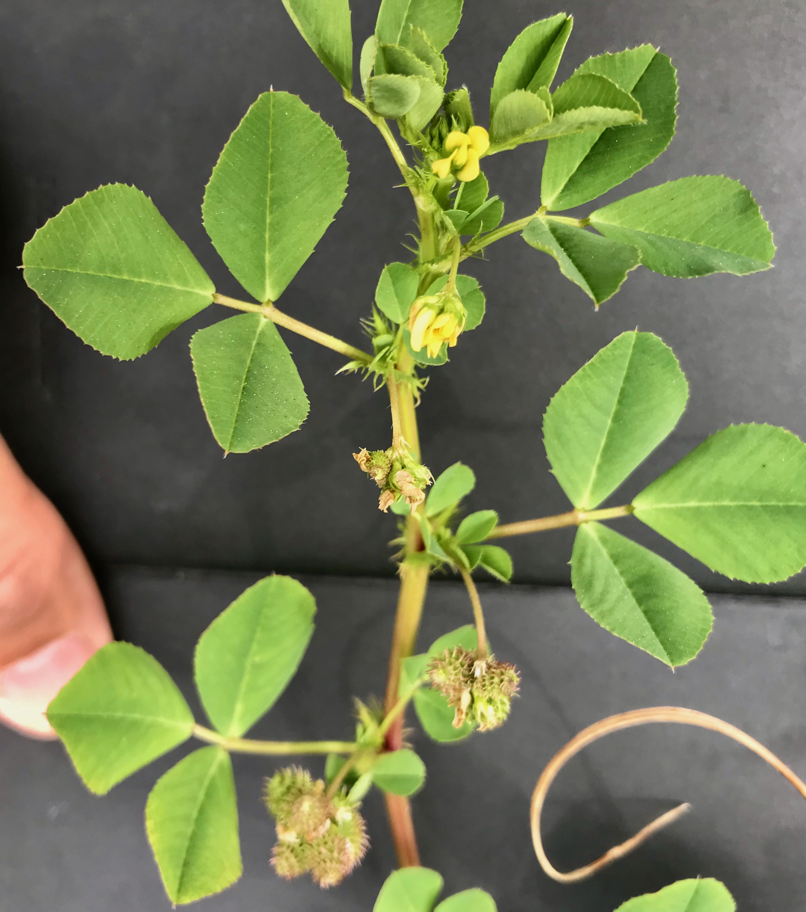
- Burr Clover – Medicago polymorpha
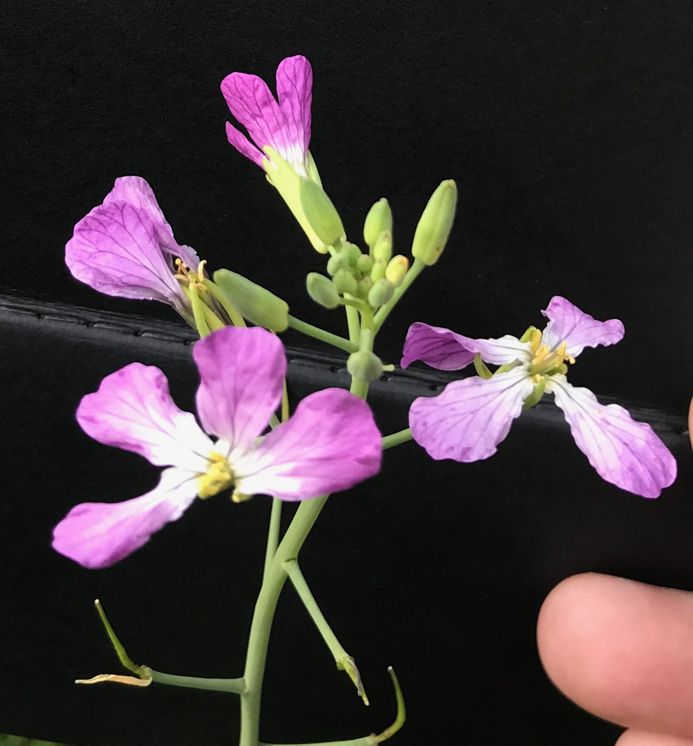
- Wild radish – Raphanus raphanistrum
- Eucalyptus tree (unidentified)
- Oak trees (several)
- Snail (shell)
- Lichen
- Tropical plants (several
- Various invasive grasses
Read: Becoming A Naturalist
Planting Natives