-
Lower Arroyo Seco: Visit 3
California Naturalist Outing
Lower Arroyo Seco Park
Pasadena, CA
8:50 a.m. – 11:30 a.m.- From the Rose Bowl Parking Lot (south side) near the aquatic center.
- Route: Footpath along the road to the trail head
- Weather: Cool 67°F at start, mid 70°s at end. Clear sky with a few high wispy clouds. Air was crisp and slightly humid.
Visit to the Upper Arroyo Seco
On this occasion, my focus was deep diving into the riparian habitat.
Starting where the trail breaks to the creek bed, I walked along the water’s edge to get a look at the topology, rocks, and soil in addition to the water quality throughout.
The water was generally very slow moving. In some pools, water was stopped/stagnant and covered in brownish green algae that was loose to the touch and would cloud the water when disturbed. These pools looked very brackish and stale with little signs of life at the very early (and cold) hour. Also in the environment were many signs of trash from storm runoff. Oil, pandemic mask, and wrappers of one kind or another were throughout. Some of the pandemic trash seemed to be medical grade (high quality) and not likely prone to breaking down in a meaningful way in the environment.
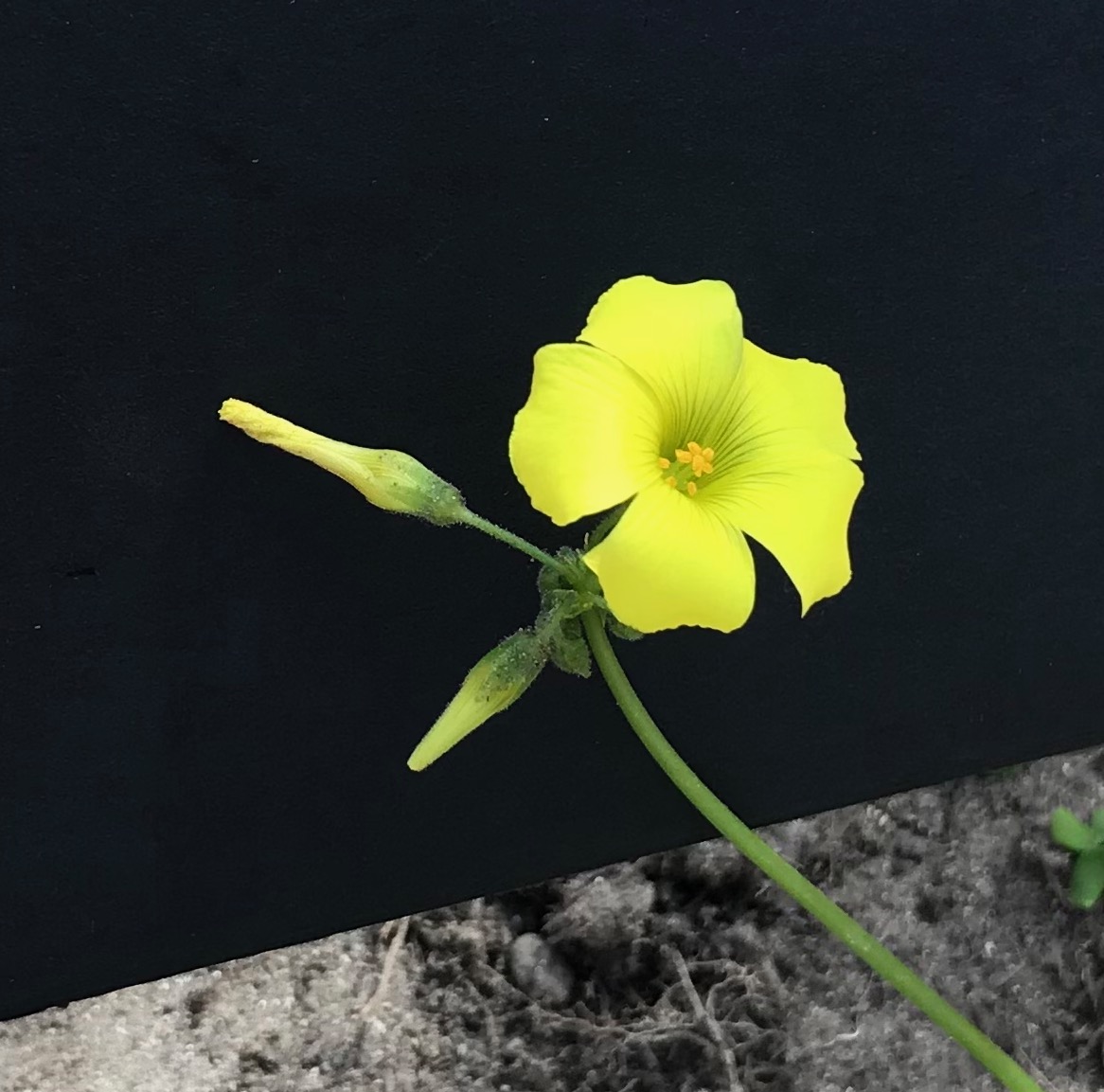
Plant-wise, there was a good mix of riparian habitat species with willows and sycamores dominating the space. Several smaller plants, including papyrus, sorrel and grasses were intertwined with English ivy and invasive grasses on the stream banks. Noticeable in a few spots were Mexican palm fans, periwinkle, and Bermuda buttercup—all looking happy in the space.


Over the Dam
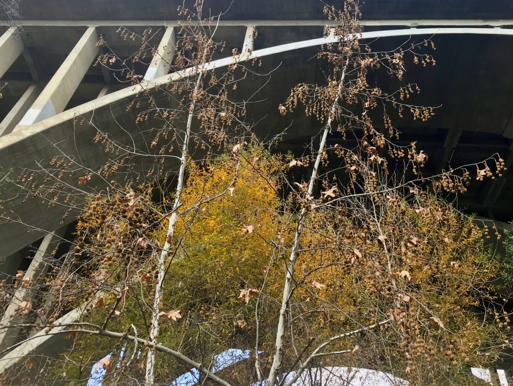
Following the wet creek (on the west side of the channel) to the first overflow dam, signs of horse, animal (dog?) and human feces littered the trail. The path to reach the check dam under the 134 freeway. Along the west side there were several curves in the creek and microclimates. In these spaces native hummingbirds with their green and fuchsia feathers darted and flew. Past the dam, the creek began to morph into a less wild mix of concrete debris, tumbled stone sand and gravel.

A in the moment illustration looking north into the riparian area of the Lower Arroyo Seco park. 
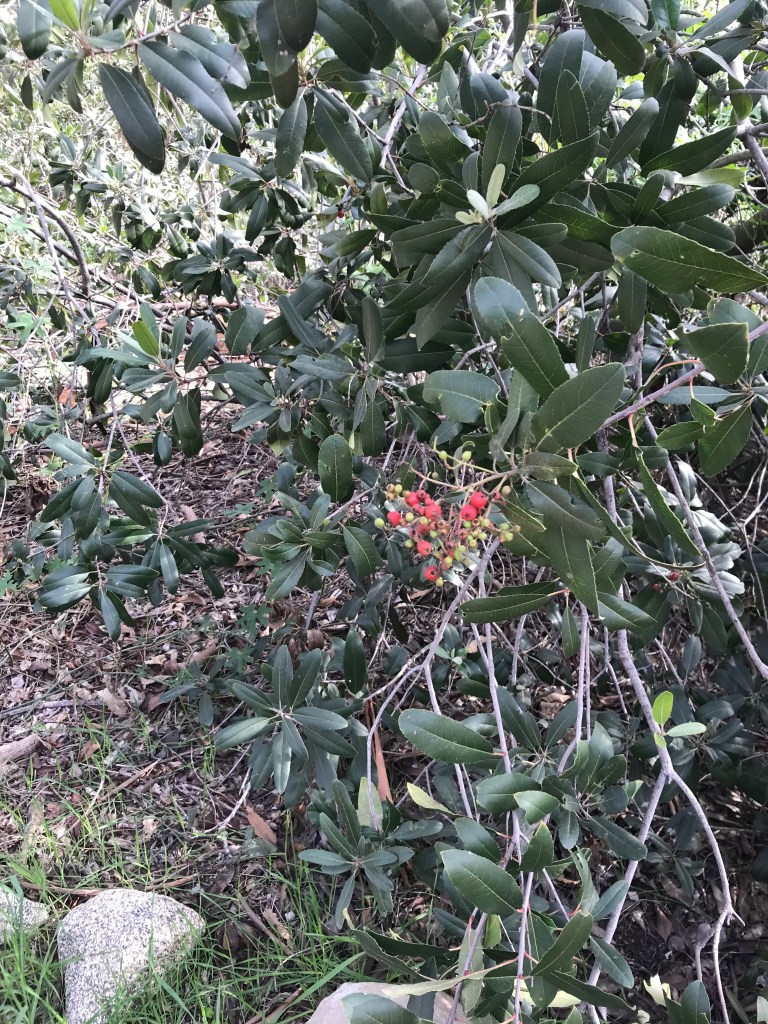
Looking north from the lower riparian area in the Lower Arroyo Seco park in Pasadena. The ecosystem past the dam took on a mix of riparian and oak forest with a hodge-podge of plants. In one spot, under the 134 on the west side, I spotted a Toyon above the bank hidden in the brush that was more than 30 feet tall and full of red berries. It appeared that this bushy tree never received more than ambient light from sun that peeked through from the south.
Moving back up stream to the trail head, I followed the dry side of the creek finding much more non-native grass, hardier riparian plants (sorrels and Bermuda buttercups, willows near the oak forest just a few yards up the embankment to the east).
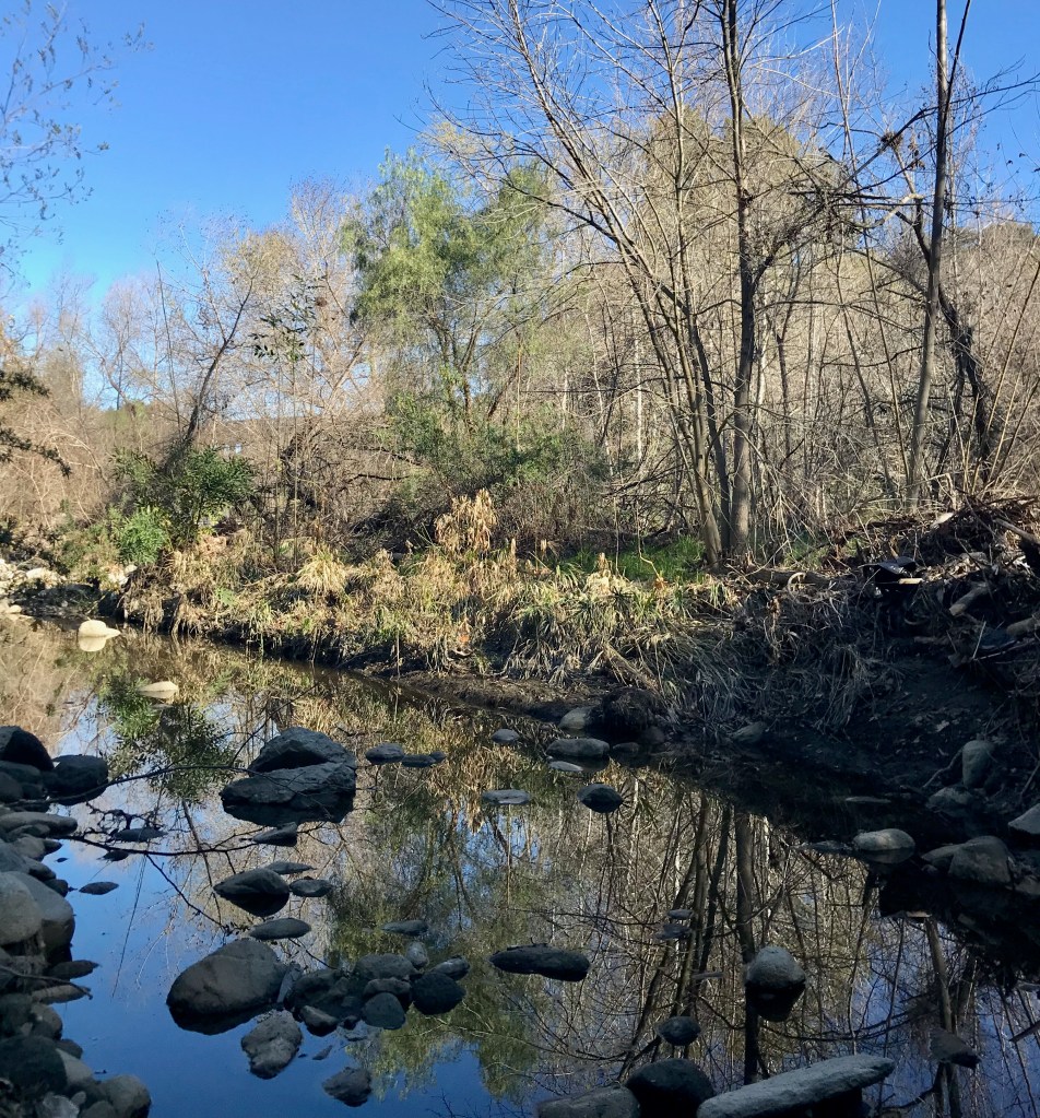
A microclimate at a bend in the creek of the upper portion of the Lower Arroyo Seco park in Pasadena. 
An illustration of the bend in the creek at the Lower Arroy Seco park in Pasadena. Field Observations:
- Few birds early on
- Hummingbirds
- Ravens
- Other birds
- Very few bugs
- Some Mallard ducks
- Bees
- Hover flies
- No/few animals
- Some mammal tracks: dog, opossum, raccoon
Species List:
- Arroyo Willow – Salix lasiolepis
- Western Sycamore – Platanus racemosa
- Bermuda buttercup (buttercup oxalis
- Mexican fan palm – Washingtonia robusta
- Peruvian Pepper tree – Schinus molle
- Stinging Nettle – Urtica dioica
- Poison Oak (sumac) – Toxicodendron vernix
- Sweet Pittosporum – Pittosporum undulatum
- Umbrella Papyrus – Cyperus alternifolius
- Various invasive grasses
-
Lower Arroyo Seco: Visit 2
California Naturalist Outing
Lower Arroyo Seco Park
Pasadena, CA
8:50 a.m. – 11:15 a.m.- From the Rose Bowl Parking Lot (south side) near the aquatic center.
- Route: Footpath along the road to the trail head
- Weather: Cool, not cold. Mid 50s. Air was moist/humid. Sky was overcast but burning off quickly.
Visit to the Upper Arroyo Seco
Down the trail into the wild area interface.
On this outing, as a group we moved down the trail through the riparian and chaparral area into the sage scrub open space. Collectively we looked at different drought adopted plants including white sage, black sage and buckwheat. In the area, invasive grasses exhibited a pervasiveness and growing in nearly every open spot of soil. On the edges, oak and toyon clung to the gentle southern slope of the arroyo wall. Lemonade berry and laurel sumacs were dotted here and there.

Lower Arroyo Seco park at La Loma Road bridge. Stopping, we asked and explored questions around why chaparral existed. As a zone, it can be prone to fire, but certain species were adapted to the erosion/fire/regrowth process. We can see why chaparral needs fire to clear away old/dead woody material to make way for new growth. That new growth pulls minerals from years of erosion of surrounding hills used in their growing process. Encroaching grasses, however, are putting pressure on native species and operate as opportunists in the space.
Geology
Further, does the geology also impact what grows in the space? Could different rocks and/or soil types hold or store water that deep rooted plants can take advantage of?
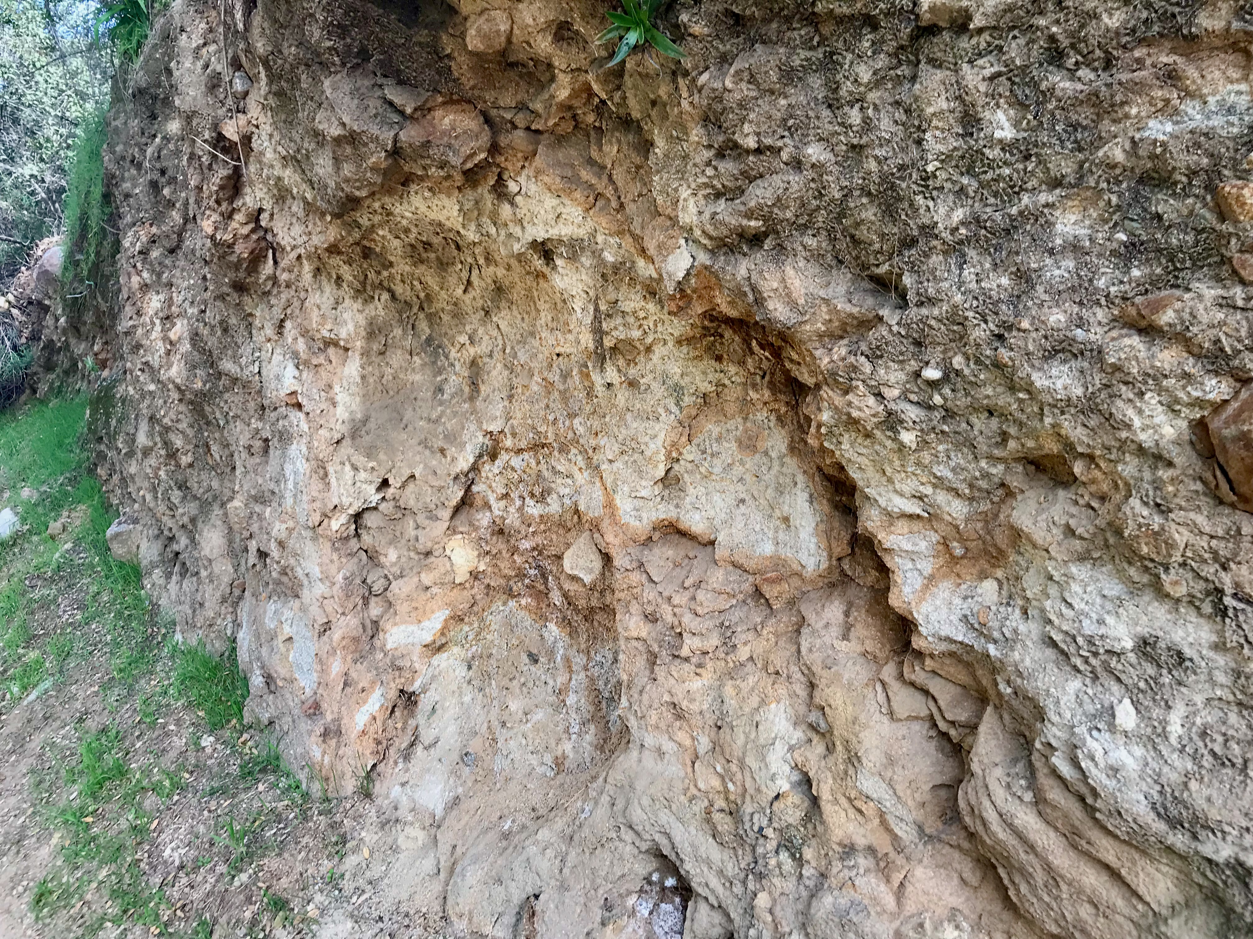
Our cohort walked further down the trail to explore the geology of the space We looked closely at the Topanga Canyon formation layer which is an old sedimentary erosion soil layer of from millennia of run off, floods and glaciation pushing the remains of long gone mountains in the Southern California region. It was VERY INTERESTING to see the minerals, stones, pebble and what I think was a fossil of some long-gone organism. Out of that layer, we observed closely how white salt deposits pushed their way through the old sedimentary layer. It was interesting to note how the salt makes the soil more alkaline and leaves a white crystalline deposit.


Field Observations:
- White sage – Salvia apiana
- Black Sage – Salvia mellifera
- Buckwheat – Eriogonum fasciculatum
- Toyon – Heteromeles arbutifolia
- Lemonade berry – Rhus integrifolia
- Laurel Sumac – Malosma laurina
- Lanceleaf liveforever – Dudleya lanceolata
- Western sycamore – Platanus racemosa
- Oak(s) – several
- Invasive grasses – several
- Topanga Canyon formation
- Salt deposits
- Old/abandoned wild beehive

-
Lower Arroyo Seco: Visit 1
California Naturalist Outing
Lower Arroyo Seco Park
Pasadena, CA
8:45 a.m. to 11 a.m.- From the Rose Bowl Parking Lot (south side) near the aquatic center.
- Route: Footpath along the road to the trail head
- Weather: Cold – low 53 F, clear sky.
Visit to the Upper Arroyo Seco
Down the trail into the wild area interface.
Riparian into Oak Scrub through microclimates out to meadow and sage scrub.
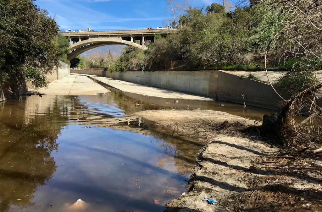
Riparian area intersected into man made river channel. Restored habitat with gravel and sandy floor. Willow and Sycamore trees and several smaller plants: papyrus and other nonnative weeds. Wood sorrels were starting to pop out from the dead plant life along the banks. Lots of trash was washed into the plant debris. Amongst the debris were the tell-tale signs of the pandemic—masks of all sorts and colors mixed in with the organic matter.

Lower Arroyo Park, looking north, where the concrete channel meets the riparian creek bed. Moving from the Riparian space to the oak forest, I moved about 50 yards from the first stop down the trail. Here, the soil was much more humus rich and less rocky. There was much more biomass on the floor. Here, the landscape was populated with Toyon, oaks and sycamore trees. The canyon space seemed to narrow and felt cooler that the air above.
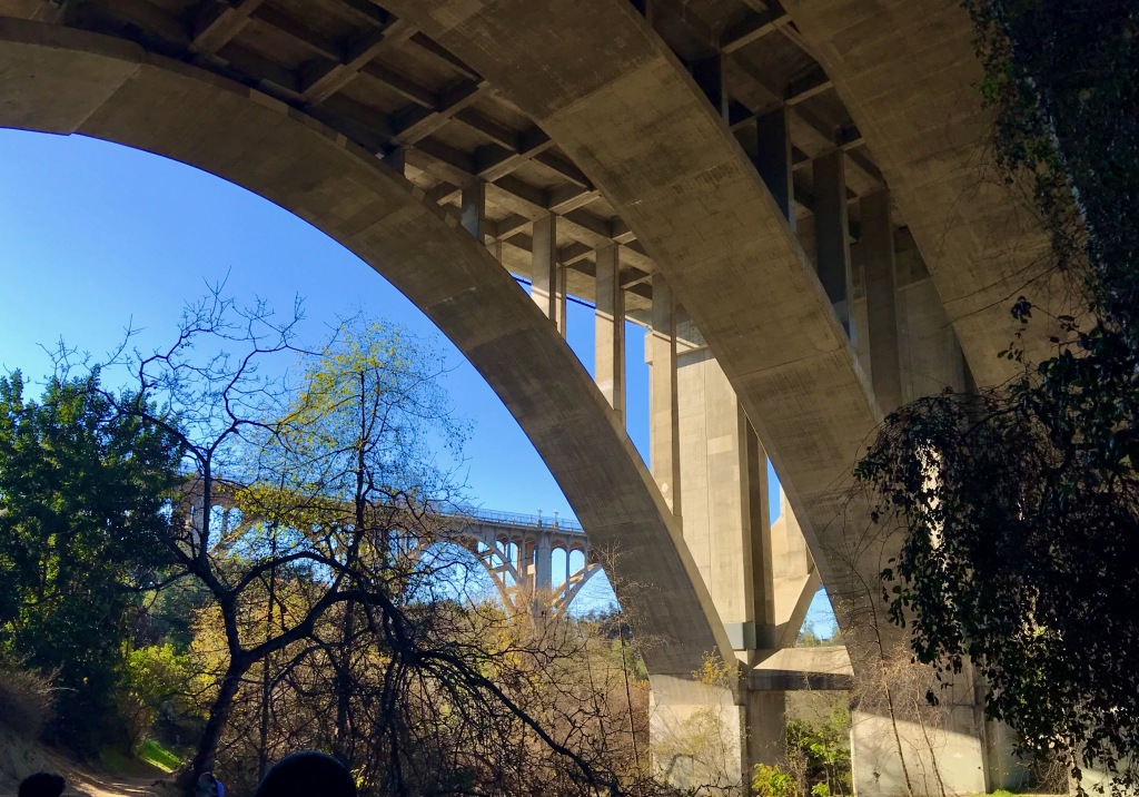
From here, I moved with the group further south, traveling under the 134 freeway (a very large bridge in the space). There were many signs of new and old human development, from the road and freeway spans to old concrete chunks embedded in the soil substrates. We traveled around the dam and through restored habitat “meadow.” The meadow is a mixed field of native and invasive plants watered by an occasional release from the concrete dam with water from the riparian areas. This space was not quite meadow, not quite riparian instead being a mix of the two.
Lower Arroyo park under the 134 freeway looking south west. Continuing south, we entered the oak forest and sage scrub chaparral open space. Here we identified a growth of poison oak and a pack rat mound.
At this point, we ended the outing and returned to the vehicles in the parking lot.
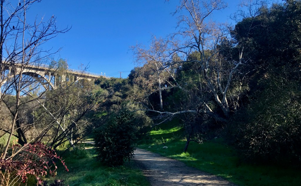
Lower Arroyo Seco Park looking north towards the Colorado Street bridge. Most notable on the trip was hearing coyotes howl after an emergency vehicle passed nearby. It really illustrated how close the wild is to the not wild space.
Planting Natives
