California Naturalist Outing
Lower Arroyo Seco Park
Pasadena, CA
8:50 a.m. – 11:45 a.m.
- From the Rose Bowl Parking Lot (south side) near the aquatic center.
- Route: Footpath along the road to the trail head.
- Weather: Clear skies, warm, 72°-74°F at start, mid 80s°F at end. The air felt hot in the sun.
Visit to the Upper Arroyo Seco
This trip was different than the previous ones as I sought to observe and note examples of local geology, human activity (past and present) and the use of the landscape by past indigenous peoples.
Also of interesting note, I followed the trail on the west side of the creek down to a point past the archery range and the La Loma Street bridge. Along that trail, I noticed many instances of what looked like old plantings of native species and many new (and old) examples of infrastructure put in place for one purpose or another. Observationally, it made for an interesting mix of very old, somewhat old, and new objects with both obvious uses and more obscure ones lost to time.
I started the excursion at the riparian creek side to take in the environment. Week to week I can see how things have changed in large and small ways. Small, such as trash and detritus debris from water releases down the channel, animal carcasses that are there one week and gone the next and other trash debris that moves with the flow of water and people in the space.


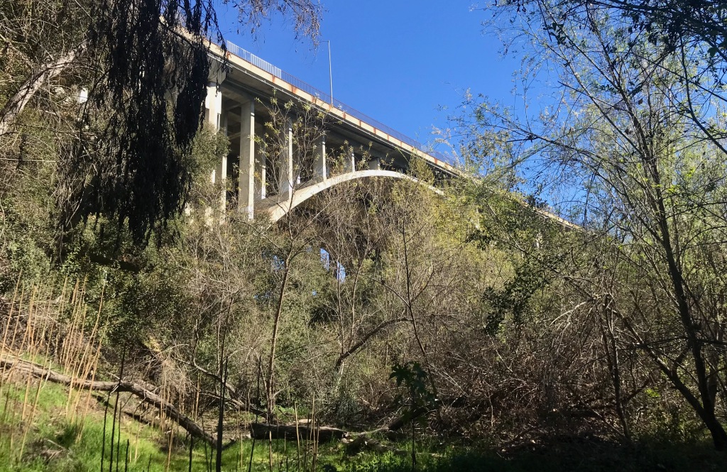
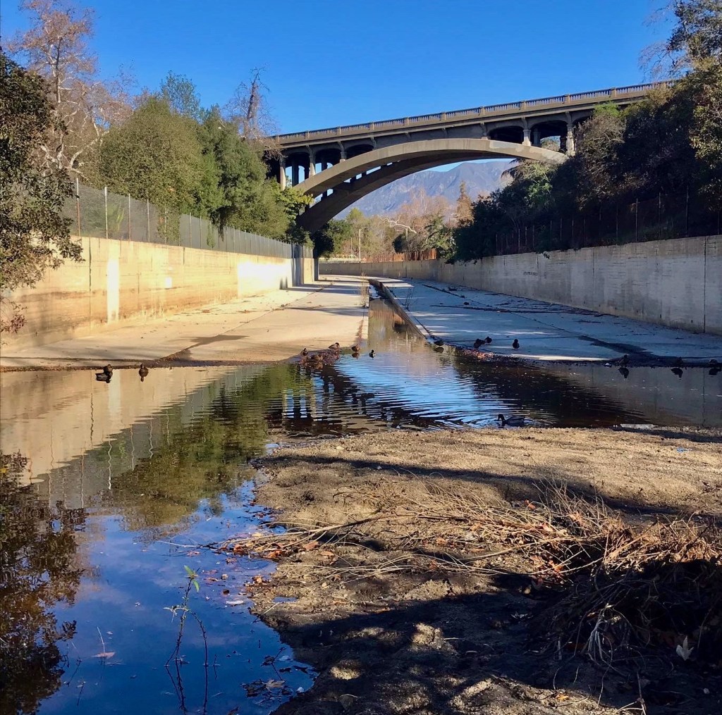
In this space, the presence of longer-term human impact is harder to see once you travel 20 yards from where the concrete water channel ends and the natural space begins. You can see the same, further down at the dam and spillway and at the larger bridges that span like giant cliffs up into the sky. These are definitely “man-made” objects and fit the anthropogenic definition of human placement in the space. And yet, they exist in the same way mountains do—monolithic, unmovable, and stoic. They exist and impose themselves in a way literally shapes the space around them. Manmade but beyond simple comprehension.
The riparian space in the Lower Arroyo is full of human made objects with concrete conglomerate cast-offs. Trash and daily life ephemera–masks and food containers abound here. Mixed into this matrix are leaves, logs and other “organic” leftovers and cast offs.

Of note in the space, was the geologic composition under the creek. RockD lists it as Quaternary/alluvium – old unit 3, late Pleistocene. In makes sense given the aspect of flowing water and the ability to send it into aquifers or at least down into the soil. It may not be much, but it’s better than letting it (now) run off into the sea.
Walking the space, I was pressed to grasp fully how past indigenous peoples would have used it year-round. My conclusion was that they wouldn’t have. The riparian creek side would be a great fishing spot when fish were running. It would have also been a nice place to escape the heat or gather water. The vegetation would also be good sources for building or crafting materials (reeds, staves, ETC.). Also, as places to bathe, track and trap animals who come down to drink from the edges.
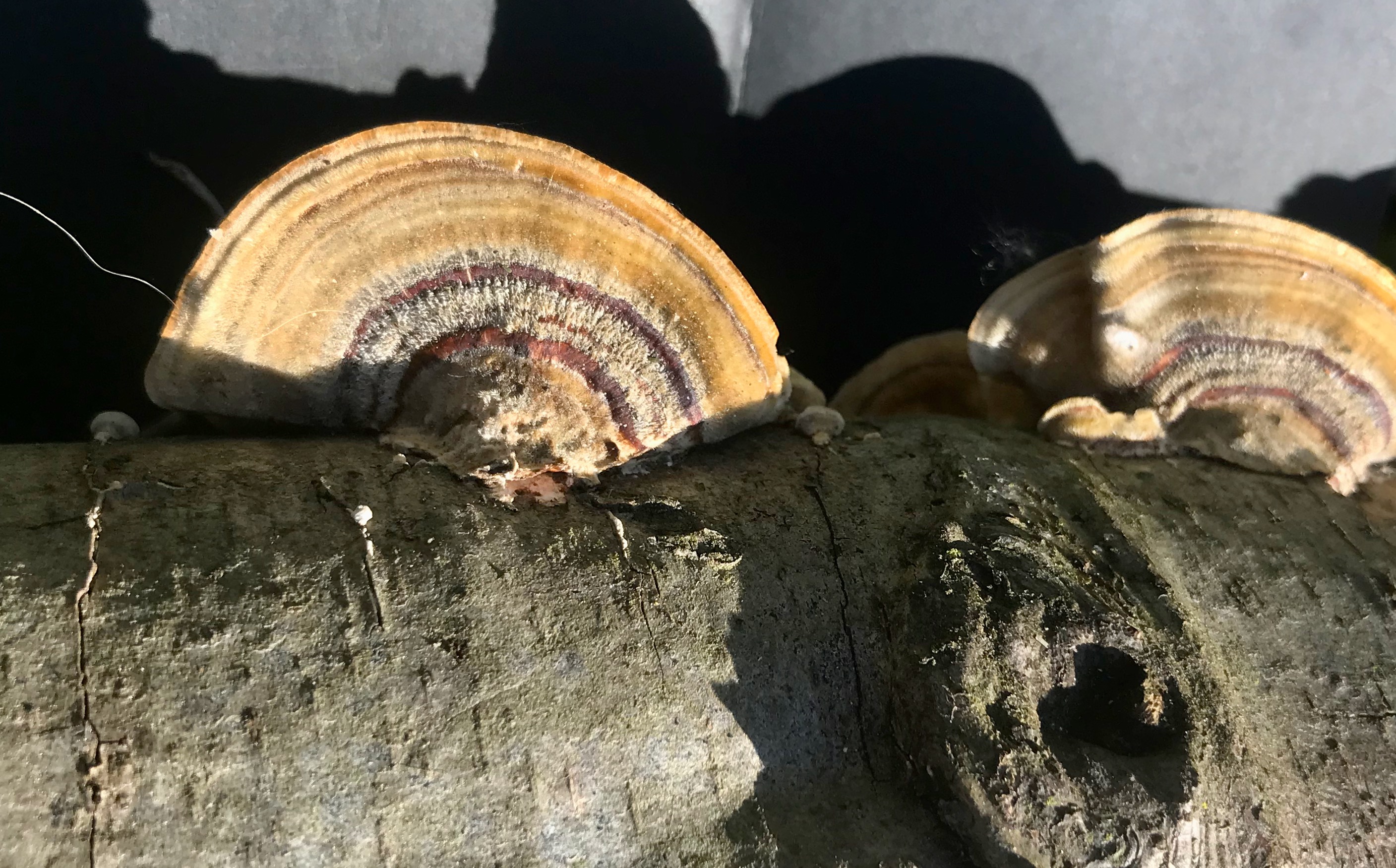
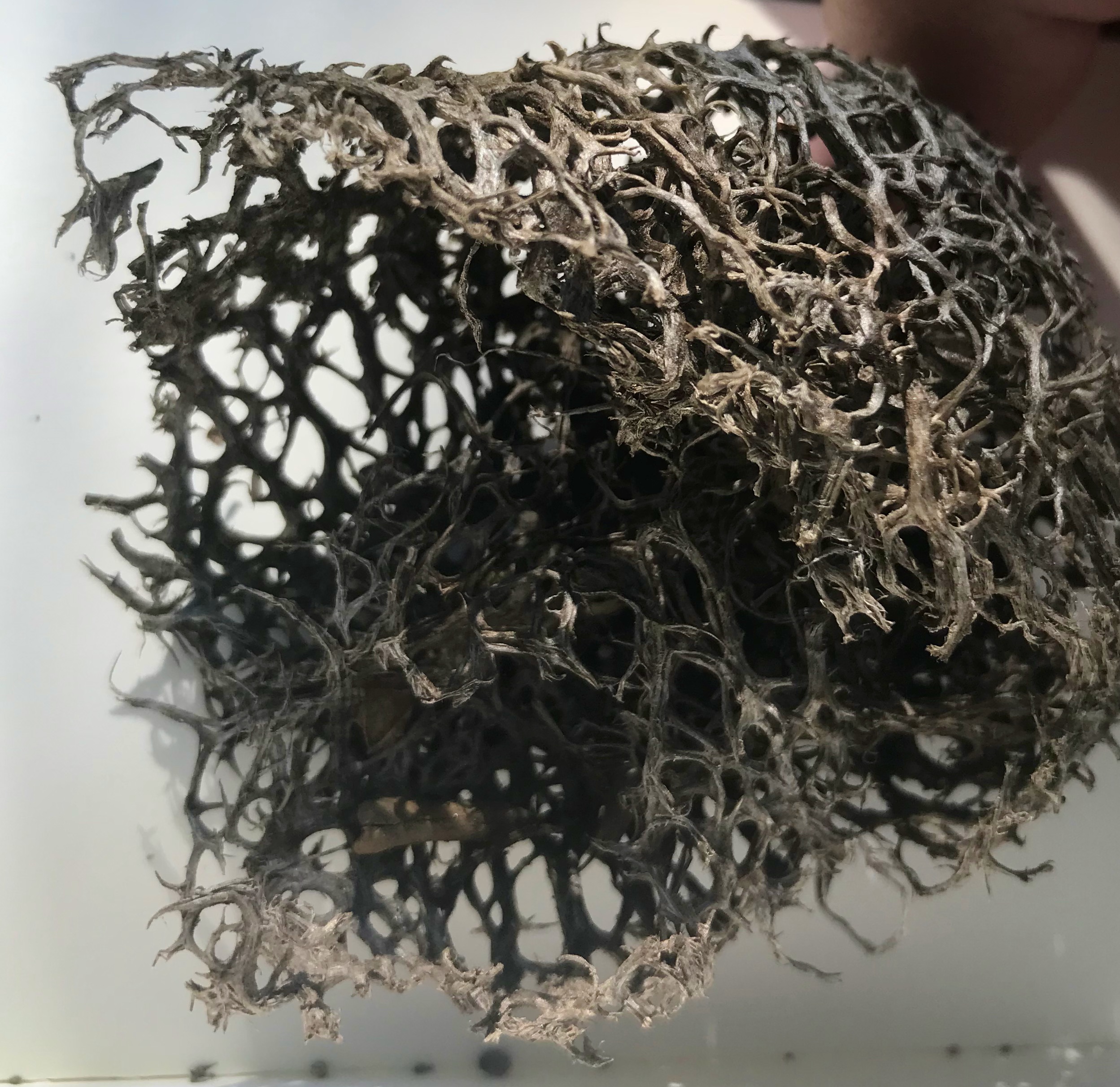
Following the creek, I crossed at the flat wash under the 134 freeway. On the west bank. I followed the creek down to the dam finding several new plants, not observed on more park like east side. This space was much more “natural” and less manicured. Plus, it seemed to represent more of the natural look and feel with oak forest and sage scrub mixing and mingling together. Some of the interesting plant species I found here included a Turkey-tail fungus, a coastal prickly pear cactus, both nestled out of view from a common path.

Further down this path, the geology turned into Mesozoic biotite, firmer and older then in the more vegetive riparian area further north. The strata under the surface were likely less eroded and deep, not collecting as much sand and small stone run-off.
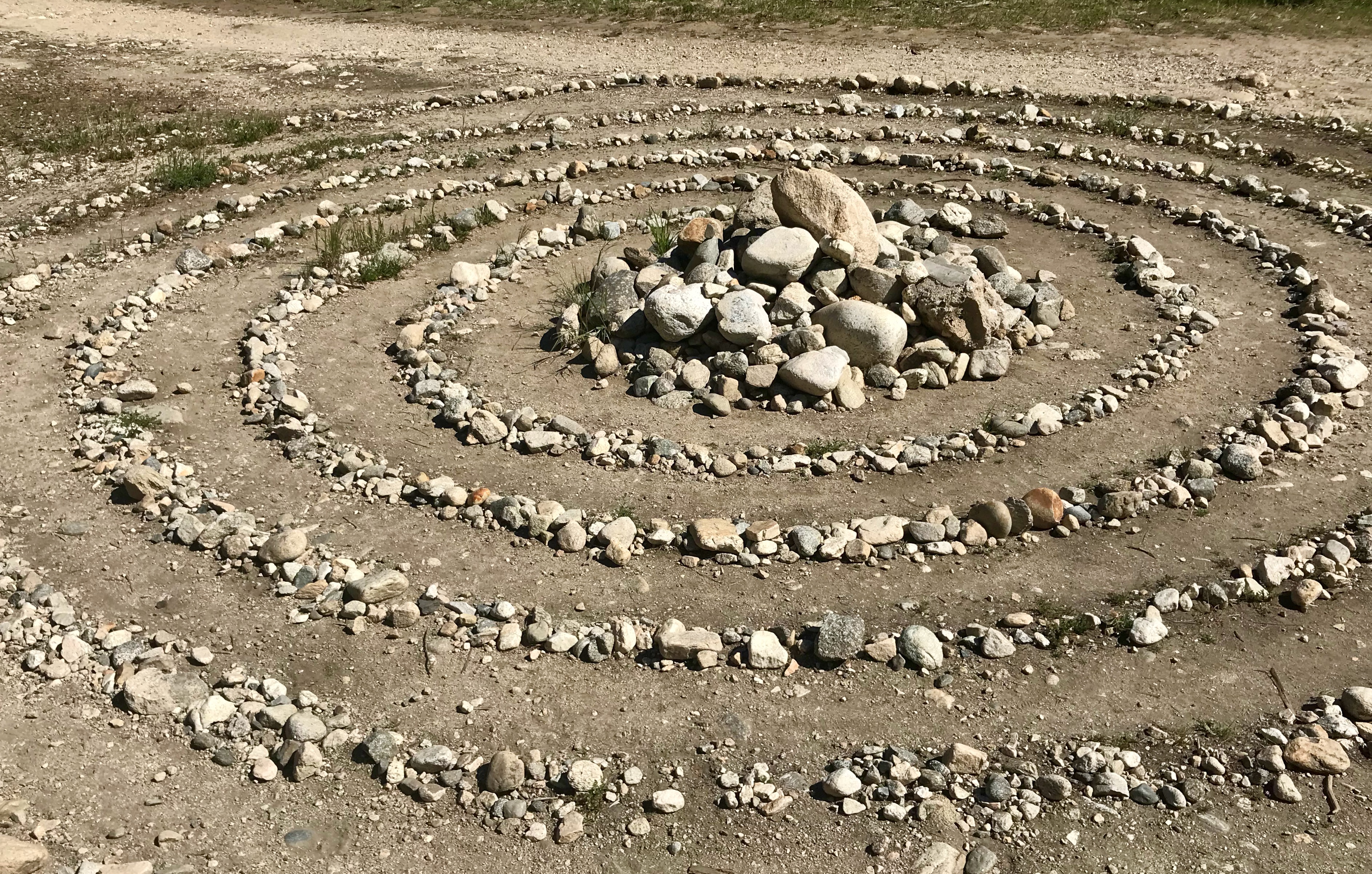
This path, from the dam down the trail to the archery range was a mix of chaparral and oak nestled between meadows along a meandering path along the western bluffs. Both above and below were signs of human occupancy jutting out from the ground. On one spot, old river rock walls and rail boulders snaked along the trail. In others, new post erected by Boy Scouts marked an empty archery range. And yet more in this space, relics of old constructions for unknown buildings sit hidden from view from the trail but scrawled with graffiti telling us we’re moving into “Wendy’s World.”


Not much father along the path were more modern monoliths including a spiral maze arranged out of found and collected rocks, hearts and a smiling face. All could have been days old or the productive of some creative force from millennia ago. One can’t help to wonder if those same activities parallel those indigenous peoples from centuries past—spending idle time in the canyon between foraging or moving between spaces.


That movement seemed to be the dominant feeling in the Lower Arroyo park. The space is anything but static: birds darting to-and-fro, lizards scurrying into brush and detritus, pack rats skulking about, all while larger animals hide in shadows to escape the midday heat or travel through and above the arroyo on monolithic bridges spanning the gap. The Lower Arroyo Seco was alive and abuzz with life and the movement of life within it.
Field Observations
- Riparian/chaparral/oak Forest ecosystems
- West Arroyo wall, many more bird and plant species (a much greater diversity)
- Old stone walls/roads, architecture without buildings
- New and not-so-new archery posts
- Far fewer people than on the east side
- More park-like infrastructure:
- Steps
- Fountains
- Hay bales (archery range)
- A trail cam
- Many man-made arches in the space (bridges) spanning the park.
Observed Species
Observed Plants
- Black Mustard – Brassica nigra
- California Buckwheat – Eriogonum fasciculatum
- California Buckeye – Aesculus californica
- chapparel bush-mallow – Malacothamnus fasciculatus
- Chapparel Whitethorn – Ceanothus leucodermis
- Coastal Prickley Pear – Opuntia littoralis
- Elderberry – Sambucus melanocarpa
- Horehound – Marrubium vulgare
- Hummingbird Sage – Salvia spathacea
- Laurel Sumac – Malosma laurina
- Lemonade Berry – Rhus integrifolia
- Poison Oak – Toxicodendron vernix
- Spiny Redberry – Rhamnus crocea
- Sugar Bush – Rhus ovata
- Toyon – Heteromeles arbutifolia
- Turkey Tail Mushroom – Trametes versicolor
- White Sage – Salvia apiana
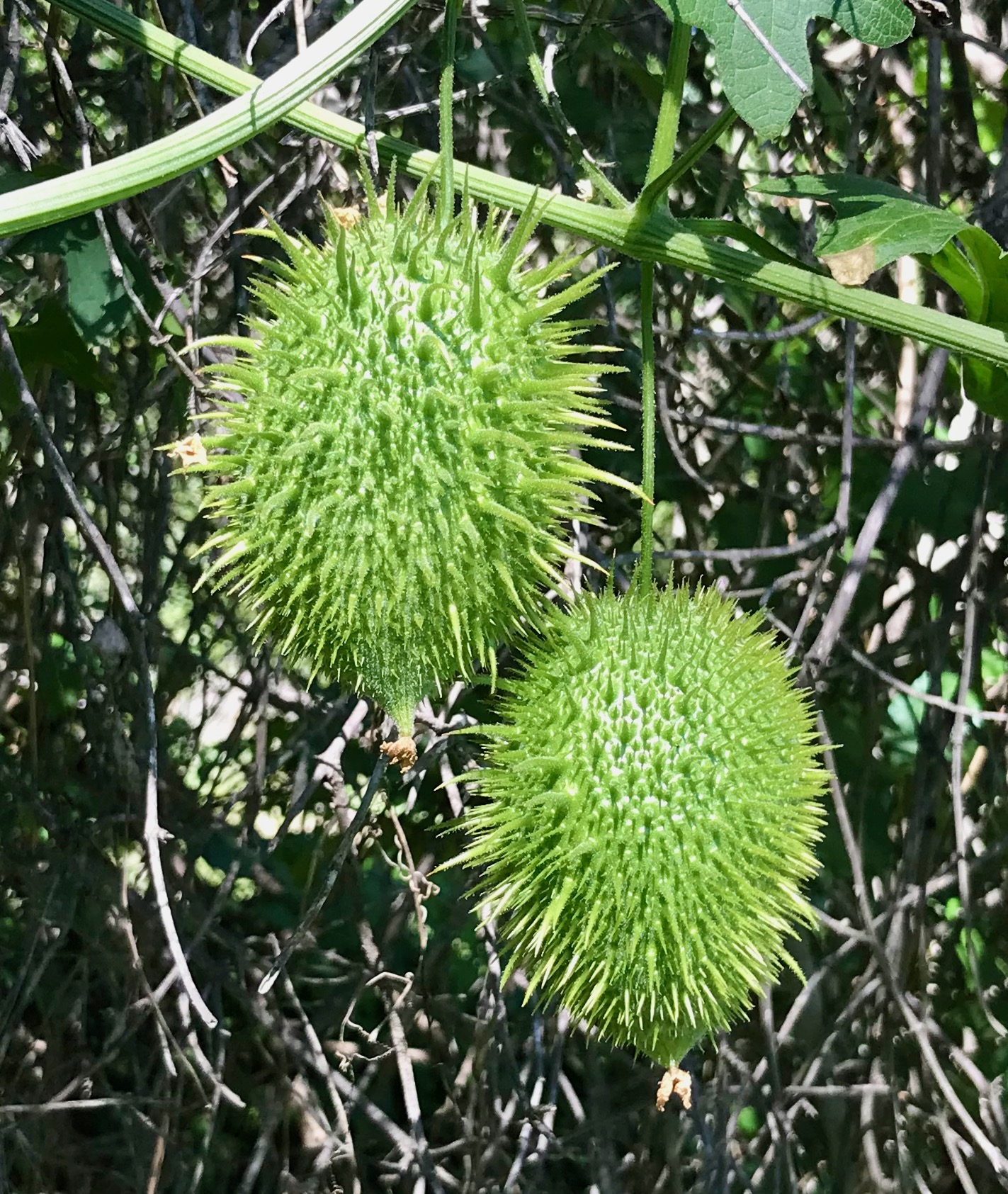
- Wild Cucumber – Chilicothe Marah macrocarpa
- Oak Trees several/various
- Weeds (many)
Observed Animals
- California Thrasher – Toxostoma redivivum
- California scrub jay – Aphelocoma californica
- House wren – Troglodytes aedon
- Hover flies Mosquitos Rabbits Sparrows
- Western fence Lizard – Sceloporus occidentalis
- Woodpecker – Melanerpes formicivorus(?)
- Gnats

5 responses to “Lower Arroyo Seco: Visit 6”
[…] Visit 2 | Visit 3 | Visit 4 | Visit 5 | Visit 6 […]
LikeLike
[…] Visit 1 | Visit 3 | Visit 4 | Visit 5 | Visit 6 […]
LikeLike
[…] Visit 1 | Visit 2 | Visit 4 | Visit 5 | Visit 6 […]
LikeLike
[…] Visit 1 | Visit 2 | Visit 3 | Visit 5 | Visit 6 […]
LikeLike
[…] Visit 1 | Visit 2 | Visit 3 | Visit 4 | Visit 6 […]
LikeLike